Cumberland Township near Gettysburg in Adams County, Pennsylvania — The American Northeast (Mid-Atlantic)
Kershaw's Brigade
McLaws's Division - Longstreet's Corps
— Army of Northern Virginia —
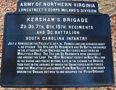
Longstreet's Corps McLaws's Division
Kershaw's Brigade
2d. 3d. 7th. 8th. 15th. Regiments
and 3d. Battalion
South Carolina Infantry
July 2 Arrived on the field at 3.30 p.m. Formed line and advanced about 4.30 o'clock. The 8th and 2d Regiments and 3d Battalion shared in the attack on Peach Orchard and Batteries near there on Wheatfield Road. The 7th and 3d Regiments were engaged at and around the Loop. The 15th Regiment fought on Rose Hill and in the ravine and forest beyond. Late in the evening the Brigade took part in the advance by which the Union forces were forced from the Wheatfield and across Plum Run Valley. At dark under orders the Brigade retired to and occupied the Peach Orchard.
Erected 1907 by Gettysburg National Military Park Commission.
Topics. This memorial is listed in this topic list: War, US Civil. A significant historical date for this entry is July 2, 1863.
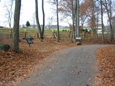
Location. 39° 47.74′ N, 77° 14.856′ W. Marker is near Gettysburg, Pennsylvania, in Adams County. It is in Cumberland Township. Memorial is on Brooke Avenue, on the left. Located in the Rose Woods, a short distance from the Avenue, in Gettysburg National Military Park. Touch for map. Marker is in this post office area: Gettysburg PA 17325, United States of America. Touch for directions.
Other nearby markers. At least 8 other markers are within walking distance of this marker. Capturing the Carnage (a few steps from this marker); 145th Pennsylvania Infantry (within shouting distance of this marker); 27th Connecticut Infantry (within shouting distance of this marker); 27th Regiment Connecticut Volunteers Position (within shouting distance of this marker); 53rd Pennsylvania Infantry (within shouting distance of this marker); Semmes's Brigade (within shouting distance of this marker); Fourth Brigade (about 300 feet away, measured in a direct line); 64th New York Infantry (about 300 feet away). Touch for a list and map of all markers in Gettysburg.
Related markers. Click here for a list of markers that are related to this marker. Kershaw's Brigade Advance as seen by markers.
Also see . . . Report of Brig. Gen. J. B. Kershaw. The General wrote one of the more detailed
accounts of the fighting in the Wheatfield-Peach Orchard sector. Of the advance and initial contact he wrote:
Under my instructions, I determined to move upon the stony hill, so as to strike it with my center, and thus attack the orchard on its left rear. Accordingly, about 4 o'clock, when I received orders to advance, I moved at once in this direction, gradually changing front to the left. The numerous fences in the way, the stone building and barn, and the morass, and a raking fire of grape and canister, rendered it difficult to retain the line in good order; but, notwithstanding these obstacles, I brought my center to the point intended. In order to restore the line of the directing battalion (the Seventh South Carolina), as soon as we reached the cover of the hill, I moved it a few paces by the right flank. Unfortunately, this order given only to Colonel [D. Wyatt] Aiken, was extended along the left of the line, and checked its advance.
Before reaching this point, I had extended an order to Colonel Kennedy, commanding Second South Carolina Regiment (my left center regiment), then moving in magnificent style, to charge

Photographed By Craig Swain, November 11, 2008
3. Kershaw's Brigade is Divided in their Attack
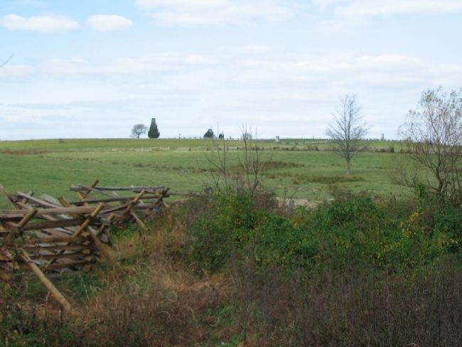
Looking from the Corner of Brook and DeTrobriand Avenues to the north. The Peach Orchard is the high ground in the distant center. To the right along the horizon line, batteries from the Federal Artillery Reserve fired upon the advancing Confederates. Kershaw split his Brigade in the open fields here to deal with the threat from the north.

Photographed By Craig Swain, November 11, 2008
4. The Stony Hill
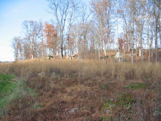
Known as the "Loop" today. Looking from DeTrobriand Avenue up the slopes of this rocky wooded hill. The 3rd and 7th South Carolina took this position from Barnes Federal Division. Barnes felt at the time his position was about to be turned, and fell back to the Wheatfield Road. In turn, Federals counterattacked with forces that included the famous Irish Brigade to wrestle the hill back, if only temporarily.
Credits. This page was last revised on February 7, 2023. It was originally submitted on January 26, 2009, by Craig Swain of Leesburg, Virginia. This page has been viewed 1,385 times since then and 20 times this year. Photos: 1, 2, 3, 4. submitted on January 26, 2009, by Craig Swain of Leesburg, Virginia.

