Ehrhardt in Bamberg County, South Carolina — The American South (South Atlantic)
Rivers Bridge State Historic Site
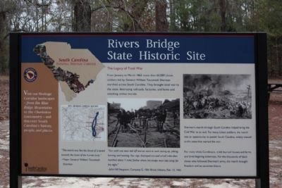
Photographed By Mike Stroud, 2009
1. Rivers Bridge State Historic Site Marker
National register of Historical places :
Rivers Bridge State Park ** (added 1972 - Site - #72001187)
Ehrhardt S.C.
Historic Significance: Event
Area of Significance: Military
Period of Significance: 1850-1874
Owner: State
Historic Function: Defense
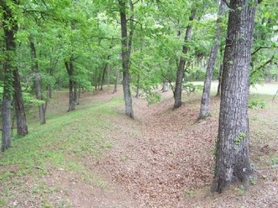
Historic Sub-function: Battle Site, Fortification
Current Function: Landscape
Current Sub-function: Park
Area of Significance: Military
Period of Significance: 1850-1874
Owner: State
Historic Function: Defense
Historic Sub-function: Battle Site, Fortification
Current Function: Landscape
Current Sub-function: Park
The Legacy of Total War
From January to March in 1865 more than 60,000 Union soldiers led by General William Tecumseh Sherman marched across South Carolina. They brought total war to the state, destroying railroads, factories and farms and attacking civilian morale.
( Right side )
Sherman's march through South Carolina helped bring the Civil War to an end. For many Union soldiers, the march was an opportunity to punish South Carolina, widely viewed as the state that started the war.
For many white Carolinians, it left burned houses and farms and bred lingering bitterness. For the thousands of black slaves who followed Sherman's army, the march brought freedom an an uncertain future.
Erected by State of South Carolina Heritage Corridor.
Topics and series. This historical marker is listed in this topic list: War, US Civil. In addition, it is included in the South Carolina Heritage Corridor series list. A significant historical year for this entry is 1865.
Location. 33° 3.693′ N, 81° 5.458′ W. Marker is in Ehrhardt, South Carolina, in Bamberg County. Marker is on Rivers Bridge State Park near SC-S-5-8. 7mi. S.W. of Ehrhardt and 13mi. E. of Allendale. Touch for map. Marker is in this post office area: Ehrhardt SC 29081, United States of America. Touch for directions.
Other nearby markers. At least 8 other markers are within walking distance of this marker. Bamberg County (about 400 feet away, measured in a direct line); Four County WW II Memorial (about 600 feet away); Rivers Bridge Confederate Dead (about 700 feet away); Our Confederate Dead (about 700 feet away); A Tradition of Remembering, A Legacy of Preservation (about 800 feet away); Colleton County Confederate Soldiers (approx. 0.2 miles away); Battle Of Rivers’ Bridge (approx. ¼ mile away); Battle of Rivers' Bridge (approx. ¾ mile away). Touch for a list and map of all markers in Ehrhardt.
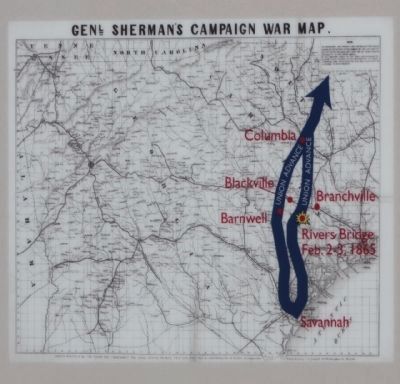
Regarding Rivers Bridge State Historic Site. Far left picture
Genl. Shermans Campaign War Map
" This march was like the thrust of a sword
towards the heart of the human body."
-Major General William Tecumseh Sherman
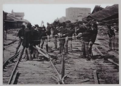
Center picture
" Our work was soon laid off and we went to
work tearing up, piling, burning, and twisting.
Our regt. destroyed one and a half miles then
marched about 7 miles farther where the troops
went into camp for the night."
- John Hill Ferguson, Company G, 10th Illinois
Infantry, Feb. 13, 1965
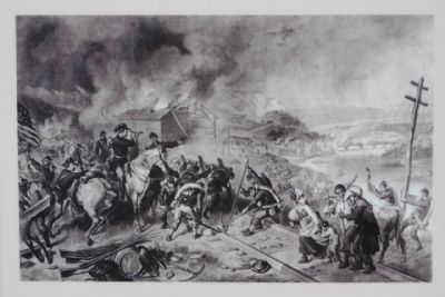
Right picture
Depicts overall scene of events
Credits. This page was last revised on June 16, 2016. It was originally submitted on January 26, 2009, by Mike Stroud of Bluffton, South Carolina. This page has been viewed 1,579 times since then and 46 times this year. Photos: 1, 2, 3, 4, 5, 6, 7, 8, 9. submitted on January 26, 2009, by Mike Stroud of Bluffton, South Carolina. • Craig Swain was the editor who published this page.
