Near Sandston in Henrico County, Virginia — The American South (Mid-Atlantic)
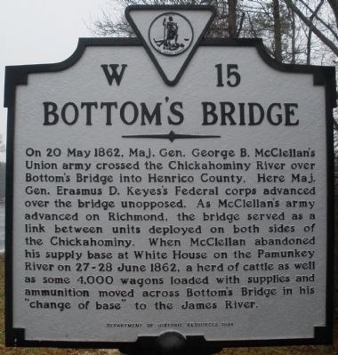
Bottom's Bridge
Erected 1994 by Department of Historic Resources. (Marker Number W-15.)
Topics and series. This historical marker is listed in this topic list: War, US Civil. In addition, it is included in the Virginia Department of Historic Resources (DHR) series list. A significant historical date for this entry is May 20, 1862.
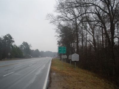
Location. 37° 30.863′ N, 77° 12.422′ W. Marker is near Sandston, Virginia, in Henrico County. Marker is on East Williamsburg Road (U.S. 60) 0.1 miles east of White Oak Road, on the right when traveling east. Touch for map. Marker is in this post office area: Quinton VA 23141, United States of America. Touch for directions.
Other nearby markers. At least 8 other markers are within 2 miles of this marker, measured as the crow flies. New Kent Road (a few steps from this marker); Capt. John Smith Captured (within shouting distance of this marker); Henrico County / New Kent County (within shouting distance of this marker); New Kent County (within shouting distance of this marker); Orapax (approx. 0.2 miles away); Elko Community Center (approx. 1˝ miles away); Meadows Fire Tower (approx. 1.9 miles away); Antioch School Site (approx. 1.9 miles away). Touch for a list and map of all markers in Sandston.
Also see . . . Virtual Tour by Markers of the Battle of Seven Pines. This is one of several markers describing the actions of May 31 - June 1, 1862. (Submitted on May 1, 2009, by Bernard Fisher of Richmond, Virginia.)
Credits. This page was last revised on August 2, 2017. It was originally submitted on January 27, 2009, by Bernard Fisher of Richmond, Virginia. This page has been viewed 1,892 times since then and 118 times this year. Photos: 1, 2. submitted on January 27, 2009, by Bernard Fisher of Richmond, Virginia. 3. submitted on March 7, 2009, by Bernard Fisher of Richmond, Virginia. • Craig Swain was the editor who published this page.


