Near Studley in Hanover County, Virginia — The American South (Mid-Atlantic)
Fighting at the Totopotomoy
Polly Hundley’s Corner
— Lee vs. Grant – The 1864 Campaign —
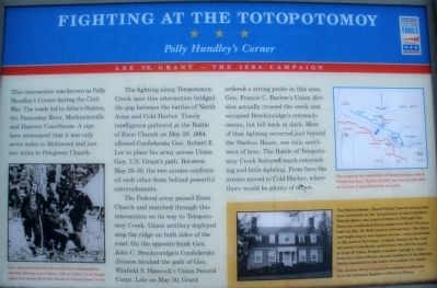
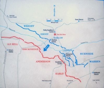
The fighting along Totopotomoy Creek near this intersection bridged the gap between the battles of North Anna and Cold Harbor. Timely intelligence gathered at the Battle of Enon Church on May 28, 1864, allowed Confederate Gen. Robert E. Lee to place his army across Union Gen. U.S. Grant’s path. Between May 28-30, the two armies confronted each other from behind powerful entrenchments.
The Federal army passed Enon Church and marched through this intersection on its way to Totopotomoy Creek. Union artillery deployed atop the ridge on both sides of the road. On the opposite bank Gen. John C. Breckinridge’s Confederate division blocked the path of Gen. Winfield S. Hancock’s Union Second Corps. Late on May 30, Grant ordered a strong probe in this area. Gen. Francis C. Barlow’s Union division actually crossed the creek and occupied Breckinridge’s entrenchments, but fell back at dark. Most of that fighting occurred just beyond the Shelton House, one mile southwest of here. The Battle of Totopotomoy Creek featured much entrenching and little fighting. From here the armies moved to Cold Harbor, where there would be plenty of action.
(sidebar):
The Shelton House, “Rural Plains,” was the most prominent landmark on the Totopotomoy Creek battlefield. Patrick Henry was married there in 1754 and Gen. Hancock established his headquarters there 110 years later on May 30, Both cannon and mortars - the latter just beginning to see regular service – were positioned in the yard of the house. A signal station on the roof attracted Confederate artillerists who hit the house at least 50 times. Despite repeated urgings to leave from the Union officers, several members of the Shelton family remained in the house throughout the battle. The Shelton house is a private residence today and is on the National Register of Historic Places.
Erected by Virginia Civil War Trails.
Topics and series. This historical marker is listed in this topic list: War, US Civil. In addition, it is included in the Former U.S. Presidents: #18 Ulysses S. Grant, and the Virginia Civil War Trails series lists. A significant historical month for this entry is May 1829.
Location. 37° 39.952′ N, 77° 20.323′ W. Marker is near Studley, Virginia, in Hanover County. Marker is on Rural Point Road (County Route 643) 0.1 miles south of Studley Road (County Route 606), on the right when traveling south. The marker is located in the parking lot of Rural Point Elementary School. Touch for map. Marker is in this post office area: Studley VA 23162, United States of America. Touch for directions.
Other nearby markers. At least 8 other markers are within walking distance of this marker. Totopotomoy Creek (approx. half a mile away); Rural Plains (approx. half a mile away); Totopotomoi (approx. half a mile away); Damaged but not Destroyed (approx. 0.6 miles away); Lives on the Line (approx. 0.6 miles away); Pine Slash (approx. 0.6 miles away); Totopotomoy Line (approx. 0.6 miles away); Digging In Under Fire (approx. 0.7 miles away).
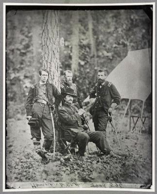
More about this marker. On the lower left is a photo of Gen. Hancock with his three division commanders (Barlow, Birney and Gibbon, left to right) in an image taken two weeks after the Battle of Totopotomoy Creek. On the upper right is a map showing the positions of the opposing armies. The map carries the caption The scope of the battlefield of Totopotomoy Creek is illustrated here. Nearly 150,000 men faced each other on a front of approximately six miles.
Regarding Fighting at the Totopotomoy. On June 1, 2006 the Totopotomoy Battlefield at Rural Plains Foundation donated the 124 acre Shelton estate to the Richmond National Battlefield Park. Contributors to the cause included the Civil War Preservation
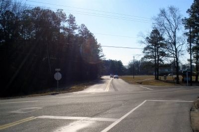
Photographed By Bernard Fisher, January 31, 2009
3. Polly Hundley's Corner (Studley & Rural Point roads)
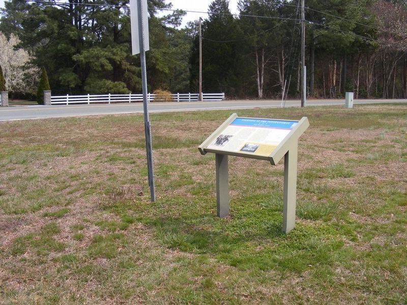
Facing south on Rural Point Road towards the Civil War Trails marker in the school parking lot. Union troops passed from left to right through this intersection on their march from the Pamunkey River to Totopotomoy Creek.
Also see . . .
1. Civil War Traveler "Lee vs. Grant: The 1864 Overland Campaign Tour". (Submitted on February 1, 2009.)
2. The Battle of Totopotomoy Creek, May 29-31, 1864. Richmond National Battlefield Park (Submitted on November 29, 2014.)
3. Totopotomoy Creek Battlefield at Rural Plains. Richmond National Battlefield Park (Submitted on November 29, 2014.)
Credits. This page was last revised on February 16, 2022. It was originally submitted on February 1, 2009, by Bernard Fisher of Richmond, Virginia. This page has been viewed 3,427 times since then and 93 times this year. Photos: 1, 2, 3. submitted on February 1, 2009, by Bernard Fisher of Richmond, Virginia. 4. submitted on March 25, 2018, by Pete Payette of Orange, Virginia. 5. submitted on November 29, 2014, by Bernard Fisher of Richmond, Virginia. • Craig Swain was the editor who published this page.
