Wrens in Jefferson County, Georgia — The American South (South Atlantic)
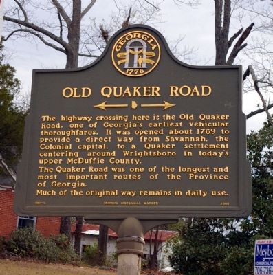
Old Quaker Road
The Quaker Road was one of the longest and most important routes of the Province of Georgia.
Much of the original way remains in daily use.
Erected 2000 by Georgia Department of Natural Resources. (Marker Number 081-5.)
Topics and series. This historical marker is listed in these topic lists: Churches & Religion • Colonial Era • Roads & Vehicles • Settlements & Settlers. In addition, it is included in the Georgia Historical Society, and the Quakerism series lists. A significant historical year for this entry is 1769.
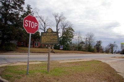
Location. 33° 12.946′ N, 82° 22.985′ W. Marker is in Wrens, Georgia, in Jefferson County. Marker is at the intersection of North Main Street (U.S. 1) and Old Quaker Road, on the right when traveling south on North Main Street. Touch for map. Marker is in this post office area: Wrens GA 30833, United States of America. Touch for directions.
Other nearby markers. At least 8 other markers are within 15 miles of this marker, measured as the crow flies. William John Wren (approx. half a mile away); Ways Baptist Church and Stellaville School (approx. 3.7 miles away); Sylvan Grove (approx. 5.8 miles away); Dr. Alexander Avera (approx. 8˝ miles away); Noted Indian Trail (approx. 14.3 miles away); Famous Indian Trail (approx. 14.4 miles away); Oliver Hardy Residence (approx. 14.4 miles away); Oliver Norvell Hardy (approx. 14˝ miles away). Touch for a list and map of all markers in Wrens.
Credits. This page was last revised on January 31, 2020. It was originally submitted on February 6, 2009, by David Seibert of Sandy Springs, Georgia. This page has been viewed 1,202 times since then and 34 times this year. Photos: 1, 2. submitted on February 6, 2009, by David Seibert of Sandy Springs, Georgia. • Kevin W. was the editor who published this page.

