Oriskany in Oneida County, New York — The American Northeast (Mid-Atlantic)
The Ambush
— 11th stop on the walking tour —
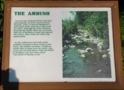
Parched and exhausted from heat and humidity on their march to Fort Stanwix, some of General Herkimer’s men broke ranks and ran to this creek for water. Although Sir John Johnson had told his Indian allies not to attack until all of Herkimer’s men had entered the ravine, they could not resist this opportunity.
As the militiamen laid down their muskets and placed their heads to the water, the Indians attacked. Tradition states that an hour into the battle, this creek ran red with blood. Thus the battle of Oriskany has also been called ‘the battle of bloody creek.”
Erected by New York State Parks.
Topics. This historical marker is listed in this topic list: War, US Revolutionary.
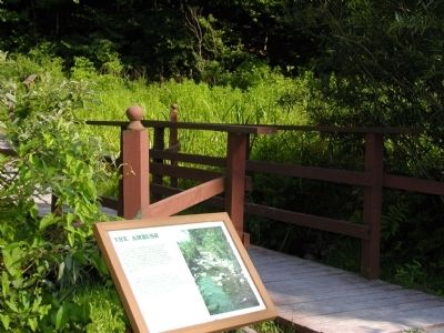
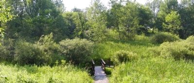
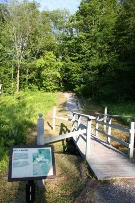
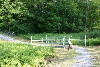
Location. Marker is missing. It was located near 43° 10.525′ N, 75° 22.1′ W. Marker was in Oriskany, New York, in Oneida County. This marker is located inside Oriskany Battlefield Park next to a small foot bridge that crosses the ravine where the initial ambush took place. Touch for map. Marker was in this post office area: Oriskany NY 13424, United States of America. Touch for directions.
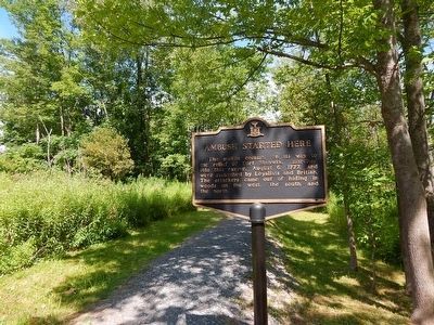
Other nearby markers. At least 8 other markers are within walking distance of this location. Ambush Started Here (a few steps from this marker); The Military Road (within shouting distance of this marker); The Ambush: August 6, 1777 (within shouting distance of this marker); Aftermath of a Tragedy (within shouting distance of this marker); Near This Spot (about 300 feet away, measured in a direct line); General Herkimer's Troops (about 300 feet away); To The Unknown Patriotic Soldiers of Tryon County (about 300 feet away); Preserving a Memorial Park (about 300 feet away). Touch for a list and map of all markers in Oriskany.
More about this marker. This marker has an image of Bloody Creek on it and it is the 11th stop on a walking tour of the Oriskany Battlefield.
Regarding The Ambush. The Battle of Oriskany is one of the bloodies battles of the American Revolution. To learn more about the battle I recommend the book: Liberty March, The Battle of Oriskany by Allan D. Foot.
Also see . . .
1. Oriskany Battlefield State Historic Site. New York State Parks, Recreation and Historical Preservation website entry (Submitted on February 13, 2009, by Bryan Olson of Syracuse, New York.)
2. The Battle of Oriskany. Wikipedia entry (Submitted on February 13, 2009, by Bryan Olson of Syracuse, New York.)
Additional commentary.
1. Removal of weathered historical markers
I stopped by this historic site on my journey to visit with my daughter's family in Connecticut. Upon arriving at in the parking area I noticed that there were some new markers, so I took the full walking tour and noticed several changes to this park site.
First, when I made my original trip here the signs indicated that it was a state park that had fallen victim to state budget cuts. This year however the park seemed to have somehow been incorporated into the national park system and I had the opportunity to speak with a national park ranger. The ranger told me that members of the National Park Service staff from neighboring Fort Stanwix rotate service over at the Oriskany Battlefield Park on a daily basis.
Second, it appeared that the National Park Service had made some improvements to the park, including changing the course of the steep walking trail through the ravine at the ambush site, removing some old and faded markers, and added some new and different markers.
From talking with the park ranger it would appear that this marker was one of the old and faded historical markers that was removed and that there is no intention of replacing this specific historical marker.
— Submitted April 14, 2012, by Dale K. Benington of Toledo, Ohio.
Credits. This page was last revised on October 25, 2021. It was originally submitted on February 13, 2009, by Bryan Olson of Syracuse, New York. This page has been viewed 1,182 times since then and 18 times this year. Photos: 1, 2, 3. submitted on February 13, 2009, by Bryan Olson of Syracuse, New York. 4. submitted on June 20, 2010, by Dale K. Benington of Toledo, Ohio. 5. submitted on February 15, 2016, by Scott J. Payne of Deposit, New York. 6. submitted on June 20, 2010, by Dale K. Benington of Toledo, Ohio. • Kevin W. was the editor who published this page.
