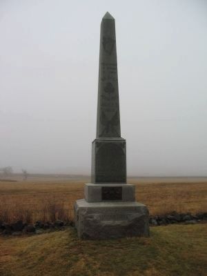
Cumberland Township near Gettysburg in Adams County, Pennsylvania — The American Northeast (Mid-Atlantic)
69th Regiment Pennsylvania Volunteers
Philadelphia Brigade
— 2nd Division, 2nd Corps —
Inscription.
(Upper Front of Shaft):
2d. Division
2d. Corps
69th Regt.
Penna. Vols.
July. 2, 3,
1863.
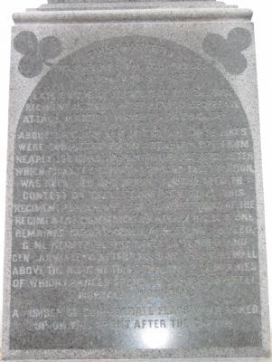
(Front):
was held by the 69th PA. Vols.,
July 2nd and 3rd 1863.
Late on the afternoon of the 2nd, this
regiment assisted in repulsing a desperate
attack made by Wright's Ga. Brigade.
About 1 O'Clock, p.m. of the 3rd, these lines
were subjected to an artillery fire from
nearly 150 guns, lasting over one hour after
which, Pickett's division charged this position,
was repulsed, and nearly annihilated. The
contest on the left and centre of this
regiment, for a time being hand-to-hand. Of the
regimental commanders attacking, but one
remained unhurt. Genl. Garnett was killed,
Genl. Kemper desperately wounded, and
Genl. Armistead, after crossing the stonewall
above the right of this command - 2 companies
of which changed front to oppose him - fell
mortally wounded.
A number of Confederate flags were picked
up on this front after the battle.
69th Pennsylvania
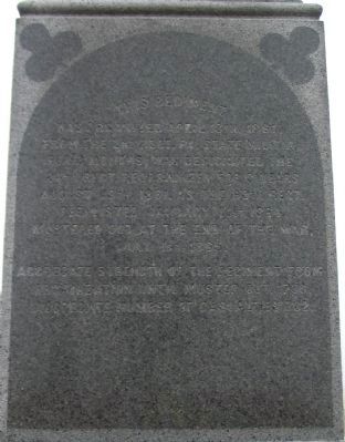
(Left):
was organized April 12, 1861
from the 2nd Regt. Pa. State Militia,
for 3 months, was designated the
24th Regt. Reorganized for 3 years
August 19th, 1861. As the 69th Regt.
Reenlisted January 31st, 1864.
Mustered out at the end of the war.
July 1st, 1865.
Aggregate strength of the regiment from
re-organization until muster out 1736
Agregate number of casualties 762
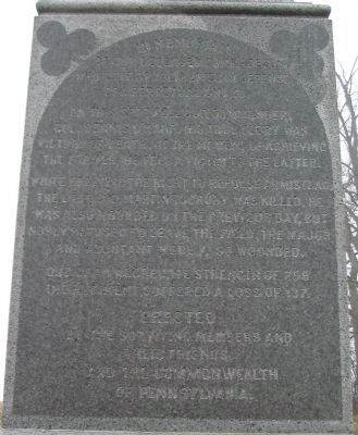
(Back):
of our deceased comrades,
who gave up their lives in defence
of a perpetual Union.
On this spot fell our commander,
Col. Dennis O'Kane, his true glory was
victory or death, at the moment of achieving
the former, he fell victim to the latter.
While rallying the right to repulse Armistead,
the Lieut. Col. Martin Tschuby was killed. He
was also wounded on the previous day, but
nobly refused to leave the field. The Major
and Adjutant were also wounded.
Out of an aggregate strength of 258
the regiment suffered a loss of 137
Erected
By the surviving members and
their friends
and the Commonwealth of Pennsylvania.
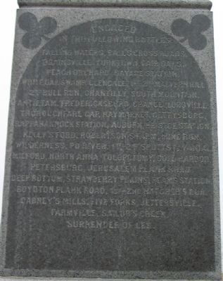
(Right):
in the following battles.
Falling Waters, Ball's Crossroads,
Dranesville, Yorktown, Fair Oaks,
Peach Orchard, Savage Station,
White Oak Swamp, Glendale, 1st & 2nd Malvern Hill,
2nd Bull Run, Chantilly, South Mountain,
Antietam, Fredericksburg, Chancellorsville,
Thoroughfare Gap, Haymarket, Gettysburg,
Rappahannock Station, Auburn, Bristoe Station,
Kelly's Ford, Robertson's Farm, Mine Run,
Wilderness, Po River, 1st-2nd Spottsylvania,
Milford, North Anna, Tolopotomy, Cold Harbor,
Petersburg, Jerusalem Plank Road,
Deep Bottom, Strawberry Plains, Reams Station,
Boydton Plank Road, 1st-2nd Hatcher's Run,
Dabney's Mills, Five Forks, Jettersville,
Farmville, Saylor's Creek,
Surrender of Lee.
Erected 1887 by Commonwealth of Pennsylvania.
Topics. This memorial is listed in this topic list: War, US Civil. A significant historical date for this entry is July 2, 1863.
Location. 39° 48.756′ N, 77° 14.178′ W. Marker is near Gettysburg, Pennsylvania, in Adams County. It is in Cumberland Township. Memorial is on Hancock Avenue, on the left when traveling north. Located near the "Copse of Trees" and the "Angle" on Cemetery Ridge in Gettysburg National Military Park. Touch for map. Marker is in this post office area: Gettysburg PA 17325, United States of America. Touch for directions.
Other nearby markers. At least 8 other markers are within walking distance of this marker. Twentieth Massachusetts Volunteer Infantry (within shouting distance of this marker); 72nd Pennsylvania Infantry (within shouting distance of this marker); Fifteenth Massachusetts Vounteer Infantry (within shouting distance of this marker); Nineteenth Massachusetts Volunteer Infantry (within shouting distance of this marker); High Water Mark (within shouting distance of this marker); 72nd Regiment Pennsylvania Volunteers (within shouting distance of this marker); 106th Pennsylvania Infantry (within shouting distance of this marker); Brigadier General Lewis Armistead, C.S.A. (within shouting distance of this marker). Touch for a list and map of all markers in Gettysburg.
Also see . . .
1. 69th Pennsylvania Infantry. Service history of the regiment. (Submitted on February 15, 2009, by Craig Swain of Leesburg, Virginia.)
2. 69th Pennsylvania Infantry. "The Forgotten Irish." (Submitted on February 15, 2009, by Craig Swain of Leesburg, Virginia.)
Credits. This page was last revised on February 7, 2023. It was originally submitted on February 15, 2009, by Craig Swain of Leesburg, Virginia. This page has been viewed 1,915 times since then and 16 times this year. Photos: 1, 2, 3, 4, 5, 6, 7, 8, 9. submitted on February 15, 2009, by Craig Swain of Leesburg, Virginia.
