Buckhead in Morgan County, Georgia — The American South (South Atlantic)
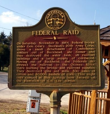
Federal Raid
Erected 1955 by Georgia Historical Commission. (Marker Number 104-5.)
Topics and series. This historical marker is listed in this topic list: War, US Civil. In addition, it is included in the Georgia Historical Society, and the Sherman’s March to the Sea series lists. A significant historical date for this entry is November 19, 1909.
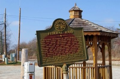
Location. 33° 34.104′ N, 83° 21.75′ W. Marker is in Buckhead, Georgia, in Morgan County. Marker is at the intersection of West Main Street and Railroad Street / Parks Mill Road, on the right when traveling south on West Main Street. Marker is located at a small gazebo in the center of Buckhead, at an intersection of the railroad tracks, West Main Street, Parks Mill Road, and Wagnon Street. Touch for map. Marker is in this post office area: Buckhead GA 30625, United States of America. Touch for directions.
Other nearby markers. At least 8 other markers are within 6 miles of this marker, measured as the crow flies. Buckhead (approx. 0.2 miles away); Fort Mathews (approx. 3 miles away); The March to the Sea (approx. 3.4 miles away); Swords (approx. 3.6 miles away); Park's Mill (approx. 4.3 miles away); Bethany (approx. 4.4 miles away); The Oconee River Railroad Bridge (approx. 4.8 miles away); Early Public Forum (approx. 5.3 miles away). Touch for a list and map of all markers in Buckhead.
Credits. This page was last revised on June 16, 2016. It was originally submitted on February 15, 2009, by David Seibert of Sandy Springs, Georgia. This page has been viewed 1,318 times since then and 45 times this year. Photos: 1, 2. submitted on February 15, 2009, by David Seibert of Sandy Springs, Georgia. • Craig Swain was the editor who published this page.

