Georgetown in Georgetown County, South Carolina — The American South (South Atlantic)
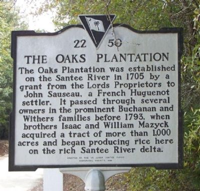
The Oaks Plantation
Erected 1999 by The St. James Santee Parish Historical Society. (Marker Number 22-50.)
Topics and series. This historical marker is listed in these topic lists: Colonial Era • Industry & Commerce • Settlements & Settlers. In addition, it is included in the South Carolina, Charleston County, St. James- Santee Parish Historical Society series list. A significant historical year for this entry is 1705.
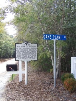
Location. 33° 13.047′ N, 79° 22.818′ W. Marker is in Georgetown, South Carolina, in Georgetown County. Marker is at the intersection of S. Fraser Street (U.S. 17) and Crow Hill Drive, on the right when traveling south on S. Fraser Street. Touch for map. Marker is in this post office area: Georgetown SC 29440, United States of America. Touch for directions.
Other nearby markers. At least 8 other markers are within 11 miles of this marker, measured as the crow flies. Hopsewee (approx. 0.4 miles away); Thomas Pinckney / St. James, Santee (approx. 3.4 miles away); St. James Santee Parish Church (approx. 5.9 miles away); Retreat Rice Plantation (approx. 6.1 miles away); Lest We Forget (approx. 7.8 miles away); 1st Battalion 178th Field Artillery (approx. 8.1 miles away); St. James Santee Parish Veterans Memorial (approx. 10.2 miles away); Richard Tillia Morrison (approx. 10.2 miles away). Touch for a list and map of all markers in Georgetown.
Regarding The Oaks Plantation. Lord Proprietor was the gubernatorial title for the noble "ruling" proprietors of certain British proprietary colonies in North America, such as Maryland or Carolina
Credits. This page was last revised on June 16, 2016. It was originally submitted on February 23, 2009, by Mike Stroud of Bluffton, South Carolina. This page has been viewed 1,942 times since then and 74 times this year. Photos: 1, 2, 3. submitted on February 23, 2009, by Mike Stroud of Bluffton, South Carolina. • Kevin W. was the editor who published this page.


