Near Mechanicsville in Hanover County, Virginia — The American South (Mid-Atlantic)
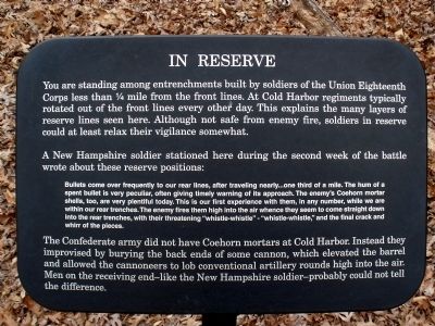
In Reserve
A New Hampshire soldier stationed here during the second week of the battle wrote about these reserve positions:
Bullets come over frequently to our rear lines, after traveling nearly…one third of a mile. The hum of a spent bullet is very peculiar, often giving timely warning of its approach. The enemy’s Coehorn mortar shells, too, are very plentiful today. This is our first experience with them, in any number, while we are within our rear trenches. The enemy fires them high into the air whence they seem to come straight down into the rear trenches, with their threatening “whistle-whistle” - “whistle-whistle,” and the final crack and whirr of the pieces.
The Confederate army did not have Coehorn mortars at Cold Harbor. Instead they improvised by burying the back ends of some cannon, which elevated the barrel and allowed the cannoneers to lob conventional artillery rounds high into the air. Men on the receiving end—like the New Hampshire soldier—probably could not tell the difference.
Erected by National Park Service.
Topics. This historical marker is listed in this topic list: War, US Civil.
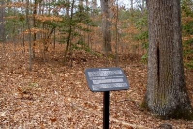
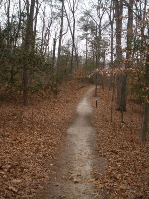
Location. 37° 35.635′ N, 77° 17.151′ W. Marker is near Mechanicsville, Virginia, in Hanover County. Marker can be reached from Anderson-Wright Drive, 0.4 miles north of Cold Harbor Road (Virginia Route 156), on the left when traveling south. This marker is located along the extended loop trail in the Cold Harbor Battlefield Unit of the Richmond National Battlefield Park. Touch for map. Marker is at or near this postal address: 5515 Anderson-Wright Drive, Mechanicsville VA 23111, United States of America. Touch for directions.
Other nearby markers. At least 8 other markers are within walking distance of this marker. The Cold Harbor Killing Fields (about 300 feet away, measured in a direct line); Grant's Grand Assault (about 700 feet away); Union Earthworks (about 700 feet away); Between the Lines (approx. 0.2 miles away); Confederate Fortifications (approx. ¼ mile away); Confederate Position (approx. ¼ mile away); 2nd Connecticut Volunteer Heavy Artillery (approx. 0.3 miles away); A Bloody Baptism of Fire (approx. 0.3 miles away). Touch for a list and map of all markers in Mechanicsville.
Also see . . .
1. Richmond National Battlefield Park. Cold Harbor. (Submitted on February 28, 2009, by Bernard Fisher of Richmond, Virginia.)
2. CWSAC Battle Summary. Cold Harbor. (Submitted on February 28, 2009, by Bernard Fisher of Richmond, Virginia.)
3. Cold Harbor Battlefield Virtual Tour by Markers. This is one of the many markers along the walking trail, extended loop trail, and auto tour route in the Cold Harbor Battlefield Unit of the Richmond National Battlefield Park. (Submitted on March 9, 2009, by Bernard Fisher of Richmond, Virginia.)
Credits. This page was last revised on June 16, 2016. It was originally submitted on February 28, 2009, by Bernard Fisher of Richmond, Virginia. This page has been viewed 826 times since then and 7 times this year. Photos: 1, 2, 3. submitted on February 28, 2009, by Bernard Fisher of Richmond, Virginia.


