Midtown Atlanta in Fulton County, Georgia — The American South (South Atlantic)
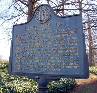
Land Lot 104
Clear Creek P.O. (1831-1839), probably in this land lot, was named for the stream flowing across it; old Montgomery Fy. Rd. traversed it.
July 18, 1864. Near its S. boundary, Confederate forces intrenched the outer Atlanta defense line from which, July 20, the troops of Walker’s & Bate’s divisions of Hardee’s Corps [CS] advanced N. to attack Federal forces posted near Collier Rd., in the Battle of Peachtree Creek -- a conflict that was confined entirely to the area west of Clear Creek.
Erected 1956 by Georgia Historical Commission. (Marker Number 060-83.)
Topics and series. This historical marker is listed in these topic lists: Agriculture • Settlements & Settlers • War, US Civil. In addition, it is included in the Georgia Historical Society series list. A significant historical month for this entry is July 1907.
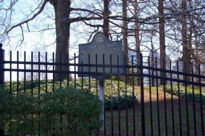
Location. 33° 47.908′ N, 84° 23.25′ W. Marker is in Atlanta, Georgia, in Fulton County. It is in Midtown Atlanta. Marker is on West Peachtree Street NE near Inwood Circle NE, on the right when traveling north. Marker in on the property of WSB-TV's studios, in a fenced and gated area. Touch for map. Marker is in this post office area: Atlanta GA 30309, United States of America. Touch for directions.
Other nearby markers. At least 8 other markers are within walking distance of this marker. The Temple (about 500 feet away, measured in a direct line); Outer Line of the Atlanta Defense (about 700 feet away); Peachtree Christian Church (about 700 feet away); Rhodes Hall - Le Reve (approx. 0.2 miles away); Margaret Mitchell (approx. 0.4 miles away); Hardee’s Attack (approx. half a mile away); The Indian Trail Echota (approx. half a mile away); 61 16th Street Apartment Building (approx. half a mile away). Touch for a list and map of all markers in Atlanta.
Credits. This page was last revised on February 8, 2023. It was originally submitted on February 28, 2009, by David Seibert of Sandy Springs, Georgia. This page has been viewed 1,455 times since then and 12 times this year. Photos: 1, 2. submitted on February 28, 2009, by David Seibert of Sandy Springs, Georgia. • Craig Swain was the editor who published this page.

