North Newport News , Virginia — The American South (Mid-Atlantic)
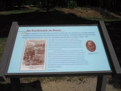
An Earthwork in Front
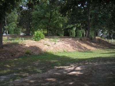
The Confederates had evacuated the Warwick-Yorktown line on May 3, 1862, after a three-week siege. The next morning the Union Army occupied the Confederate earthworks and pursued their retreating enemy. The Federal IV Corps advanced up the Great Warwick Road from Lee’s Mill toward Lee Hall. Brig. Gen. William “Baldy” Smith’s division led the infantry march screened by Capt. William Chambliss’ squadron of the 5th U.S. Cavalry. Elements of the Jeff Davis Legion of Mississippi, covering the Confederate retreat, awaited the Union advance in this redoubt.
In his report Capt. Chambliss wrote, “At the recent headquarters of General Magruder, situated on a commanding eminence, with an earthwork in front, I again discovered the pickets of the enemy, strongly posted in the work and in the rear of the building.” Here, the 5th U.S. Cavalry fought a brief skirmish with the Jeff Davis Legion. The Union troopers carried only revolvers and sabers while the Confederates were armed with shotguns and carbines. Faced with heavy fire, Chambliss regrouped his squadron and sent out a flanking party. This prompted the Mississippians to abandon this position and rejoin their other comrades behind Skiffes Creek. Afterwards, Smith’s division marched past Lee Hall toward the cavalry and artillery battle near Williamsburg.
Topics. This historical marker is listed in this topic list: War, US Civil. A significant historical month for this entry is May 1862.
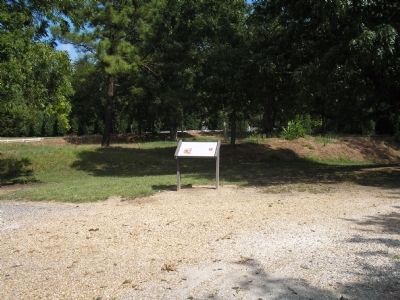
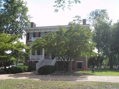
Location. Marker has been reported permanently removed. It was located near 37° 11.984′ N, 76° 34.497′ W. Marker was in Newport News, Virginia. It was in North Newport News. Marker could be reached from Yorktown Road (Virginia Route 238), on the left when traveling north. Marker is located on the grounds of Lee Hall Mansion. Touch for map. Marker was in this post office area: Newport News VA 23603, United States of America.
We have been informed that this sign or monument is no longer there and will not be replaced. This page is an archival view of what was.
Other nearby markers. At least 8 other markers are within walking distance of this location. An Earthwork In Front (here, next to this marker); Largest and Most Valuable Estate in the County (within shouting distance of this marker); A Large Brick Kitchen (within shouting
distance of this marker); Master and Slaves (about 300 feet away, measured in a direct line); Homestead by the Main Road (about 300 feet away); Lee Hall (about 400 feet away); a different marker also named Lee Hall (about 600 feet away); Lee Hall Village (approx. 0.4 miles away). Touch for a list and map of all markers in Newport News.
More about this marker. The left side of the marker features a photograph of a sketch of Confederates “falling back from the Peninsula, May 1862.” Photo courtesy of the Virginia Historical Society. The right of the marker contains a photograph of Capt. William P. Chambliss, courtesy of USAMHI.
Also see . . . Lee Hall Mansion. (Submitted on February 28, 2009, by Bill Coughlin of Woodland Park, New Jersey.)
Credits. This page was last revised on February 1, 2023. It was originally submitted on February 28, 2009, by Bill Coughlin of Woodland Park, New Jersey. This page has been viewed 1,294 times since then and 12 times this year. Last updated on November 6, 2021, by Bradley Owen of Morgantown, West Virginia. Photos: 1, 2, 3, 4. submitted on February 28, 2009, by Bill Coughlin of Woodland Park, New Jersey. • Bernard Fisher was the editor who published this page.


