North Newport News , Virginia — The American South (Mid-Atlantic)
The Dairy Building
The Civil War at Endview
— A living history museum —
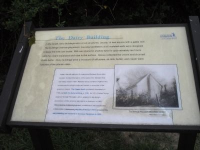
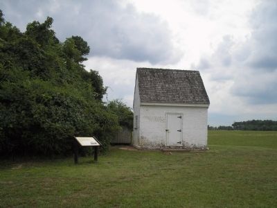
Sidebar: Captain Samuel Mathews, Sr. established Mathews Manor (later renamed Denbigh Plantation) on the banks of the Warwick River near Deep Creek in 1625. Mathews was a prominent Virginian who commanded the colony’s militia and served as a member of the governor’s council. The Digges family purchased the property in 1720 and built this dairy building, c. 1740. By 1813, Richard Young acquired Denbigh Plantation, which remained in the family’s possession until the property was sold to a developer in 1963. After extensive archaeological work, a subdivision was constructed in the 1970s. Subsequently, the City of Newport News acquired the dairy building and moved it to Endview Plantation in 1999.
Erected by Endview Living History Museum.
Topics. This historical marker is listed in these topic lists: Agriculture • Colonial Era • Settlements & Settlers. A significant historical year for this entry is 1625.
Location. Marker has been reported permanently removed. It was located near 37° 12.636′ N, 76° 34.205′ W. Marker was in Newport News, Virginia. It was in North Newport News. Marker could be reached from Yorktown Road (Virginia Route 238), on the right when traveling north. Marker is on the grounds of the Endview living history museum. Touch for map. Marker was in this post office area: Newport News VA 23603, United States of America.
We have been informed that this sign or monument is no longer there and will not be replaced. This page is an archival view of what was.
Other nearby markers. At least 8 other markers are within walking distance of this location. The Dairy House (a few steps from this marker); The Endview Spring (about 300 feet away, measured in a direct line); The Endview Landscape (about 400 feet away); Endview (about 400 feet away); Endview Plantation (about 400 feet away); The Cemetery (about 500 feet away); a different marker also named Endview (approx. 0.2 miles away); a different marker also named Endview (approx. 0.2 miles away). Touch for a list and map of all markers in Newport News.
More about this marker. The bottom right of the marker features a 1937 photograph of The Denbigh Plantation dairy building. Photo courtesy of The Library of Virginia.
Related marker. Click here for another marker that is related to this marker. New Marker At This Location titled "The Dairy House".
Credits. This page was last revised on February 1, 2023. It was originally submitted on March 1, 2009, by Bill Coughlin of Woodland Park, New Jersey. This page has been viewed 1,300 times since then and 97 times this year. Last updated on November 5, 2021, by Bradley Owen of Morgantown, West Virginia. Photos: 1, 2, 3. submitted on March 1, 2009, by Bill Coughlin of Woodland Park, New Jersey. • Bernard Fisher was the editor who published this page.


