Near Fredericksburg in Spotsylvania County, Virginia — The American South (Mid-Atlantic)
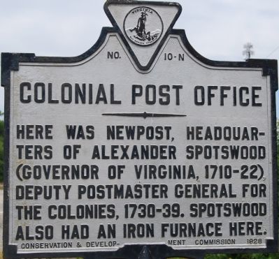
Colonial Post Office
Erected 1928 by Conservation & Development Commission. (Marker Number N-10.)
Topics and series. This historical marker is listed in these topic lists: Colonial Era • Communications. In addition, it is included in the Postal Mail and Philately, and the Virginia Department of Historic Resources (DHR) series lists.
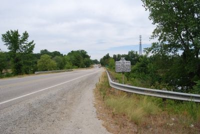
Location. 38° 14.231′ N, 77° 24.645′ W. Marker is near Fredericksburg, Virginia, in Spotsylvania County. Marker is on Tidewater Trail (Virginia Route 2) 0.6 miles east of Jim Morris Road (County Route 609), on the left when traveling east. Touch for map. Marker is at or near this postal address: 10121 Tidewater Trail, Fredericksburg VA 22408, United States of America. Touch for directions.
Other nearby markers. At least 8 other markers are within 2 miles of this marker, measured as the crow flies. The Winter Line (approx. 0.6 miles away); The Gallant Pelham (approx. 0.6 miles away); Confederate Earthworks (approx. 0.6 miles away); a different marker also named The Gallant Pelham (approx. 1.4 miles away); The Battle of Fredericksburg (approx. 1.4 miles away); Stuart and Pelham (approx. 1.4 miles away); a different marker also named The Gallant Pelham (approx. 1.4 miles away); Fort Hood (approx. 1.4 miles away). Touch for a list and map of all markers in Fredericksburg.
Credits. This page was last revised on February 2, 2023. It was originally submitted on July 13, 2007, by Dawn Bowen of Fredericksburg, Virginia. This page has been viewed 1,442 times since then and 28 times this year. Photos: 1, 2. submitted on July 13, 2007, by Dawn Bowen of Fredericksburg, Virginia. • J. J. Prats was the editor who published this page.

