Near Providence Forge in New Kent County, Virginia — The American South (Mid-Atlantic)
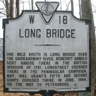
Long Bridge
Erected 1947 by Virginia Conservation Commission. (Marker Number W-18.)
Topics and series. This historical marker is listed in these topic lists: War, US Civil • War, US Revolutionary. In addition, it is included in the Virginia Department of Historic Resources (DHR) series list. A significant historical date for this entry is May 4, 1862.
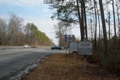
Location. 37° 28.866′ N, 77° 7.83′ W. Marker is near Providence Forge, Virginia, in New Kent County. Marker is at the intersection of Pocahontas Trail (U.S. 60) and Roxbury Road, on the right when traveling east on Pocahontas Trail. Touch for map. Marker is at or near this postal address: 5009 S Garden Rd, Providence Forge VA 23140, United States of America. Touch for directions.
Other nearby markers. At least 8 other markers are within 5 miles of this marker, measured as the crow flies. Letitia Christian Tyler (here, next to this marker); a different marker also named Long Bridge (approx. 0.4 miles away); Arnold Stansley (approx. 3.1 miles away); Action of Nance's Shop (approx. 3.6 miles away); George W. Watkins School (approx. 3.8 miles away); Green v. County School Board of New Kent County (approx. 3.8 miles away); Roxbury (approx. 4 miles away); Stuart's Ride Around McClellan (approx. 4.2 miles away).
Credits. This page was last revised on November 10, 2021. It was originally submitted on March 7, 2009, by Bernard Fisher of Richmond, Virginia. This page has been viewed 1,750 times since then and 62 times this year. Photos: 1, 2, 3. submitted on March 7, 2009, by Bernard Fisher of Richmond, Virginia.


