Comus near Dickerson in Montgomery County, Maryland — The American Northeast (Mid-Atlantic)
Mt. Ephraim Crossroads
Sharpshooters Hold the Line
— Antietam Campaign 1862 —
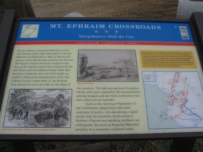
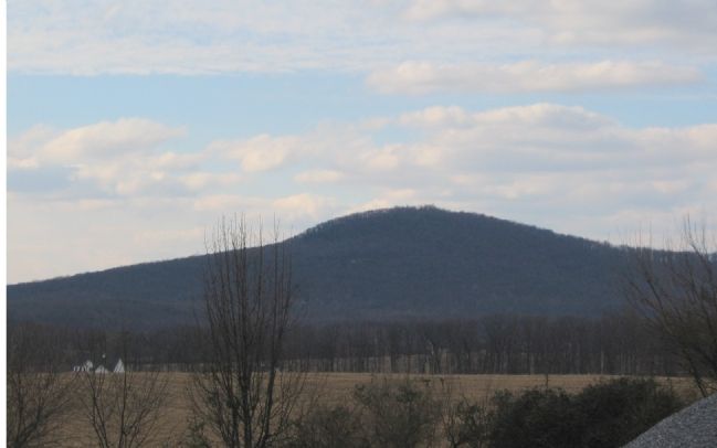
You are looking at Sugarloaf Mountain, where the running cavalry fight that began in the late afternoon on September 9, 1862, in Barnesville came to a halt. By the next morning, the 7th and 9th Virginia Cavalry had been brought to bay here at the southern base of the mountain by the 8th Illinois and 3rd Indiana Cavalry. Both sides had been reinforced, and each had brought up artillery. Dismounted sharpshooters of the 2nd Virginia Cavalry looked down on the Federals from among the trees and rocks on the slopes of the mountain. The fighting continued throughout the day with much cannon fire. By evening neither side had budged, and one Union cavalryman had been killed and one wounded.
Early on the morning of September 11, the Confederates slipped away after brief exchanges of gunfire, also abandoning a signal station atop the mountain. As the Army of Northern Virginia was marching northwest out of Frederick, the action at Sugarloaf Mountain proved to be a successful rear guard action.
(Sidebar)
The Comus Inn was the Benjamin Johnson family farm at the time of the Civil War, and the crossroads was known as Mt. Ephraim. The family’s log cabin was added to in the 1890s. The name Comus (Roman god of revelry and son of Bacchus) was not used until a post office was established here in 1930. In the 1930s, President Franklin D. Roosevelt wanted to acquire Sugarloaf Mountain as his presidential retreat, but the owner, Gordon Strong, refused to sell, so the president went north to Shangri-La, now Camp David.
Erected by Maryland Civil War Trails.
Topics and series. This historical marker is listed in this topic list: War, US Civil. In addition, it is included in the Maryland Civil War Trails series list. A significant historical date for this entry is September 9, 1862.
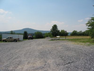
Location. This marker has been replaced by another marker nearby. It was located near 39° 14.893′ N, 77° 20.999′ W. Marker was near Dickerson, Maryland, in Montgomery County. It was in Comus. Marker could be reached from the intersection of Old Hundred Road (Maryland Route 109) and Comus Road (Maryland Route 95), on the left when traveling north. Located in the rear of a parking lot for the Comus Inn. Touch for map. Marker was at or near this postal address: 23900 Old Hundred Rd, Dickerson MD 20842, United States of America. Touch for directions.
Other nearby markers. At least 8 other markers are within 3 miles of this location, measured as the crow flies. Mount Ephraim Crossroads (here, next to this marker); 1862 Antietam Campaign (here, next to this marker); Comus Inn (about 300 feet away, measured in a direct line); Sugarloaf Mountain (approx. 2.3 miles away); Sugar Loaf Mountain (approx. 2.4 miles away); Barnesville (approx. 2½ miles away); a different marker also named Barnesville (approx. 2½ miles away); Women on the Homefront in Montgomery County (approx. 2.8 miles away). Touch for a list and map of all markers in Dickerson.
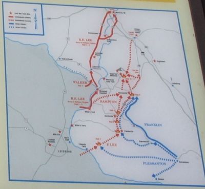
More about this marker. The marker features two drawings from the war. The first is depicts J.E.B. Stuart’s cavalry on their way to the Potomac River. The second is an impression of Sugarloaf Mountain, with a lot of artistic license. A map displays the unit movements pertaining to the Antietam Campaign.
Related marker. Click here for another marker that is related to this marker. New Marker At This Location titled "Mount Ephraim Crossroads"
Also see . . . Our Story - The Comus Inn. Inn website entry (Submitted on July 14, 2007, by Craig Swain of Leesburg, Virginia.)
Credits. This page was last revised on December 5, 2023. It was originally submitted on July 14, 2007, by Craig Swain of Leesburg, Virginia. This page has been viewed 2,243 times since then and 35 times this year. Photos: 1, 2, 3, 4. submitted on July 14, 2007, by Craig Swain of Leesburg, Virginia. • J. J. Prats was the editor who published this page.


