Near Mechanicsville in Hanover County, Virginia — The American South (Mid-Atlantic)
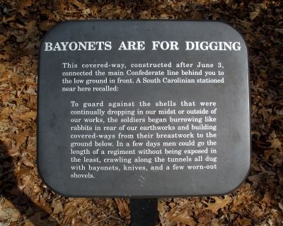
Bayonets Are For Digging
To guard against the shells that were continually dropping in our midst or outside of our works, the soldiers began burrowing like rabbits in rear of our earthworks and building covered-ways from their breastwork to the ground below. In a few days men could go the length of a regiment without being exposed in the least, crawling along the tunnels all dug with bayonets, knives, and a few worn-out shovels.
Erected by National Park Service.
Topics. This historical marker is listed in this topic list: War, US Civil. A significant historical date for this entry is June 3, 1865.
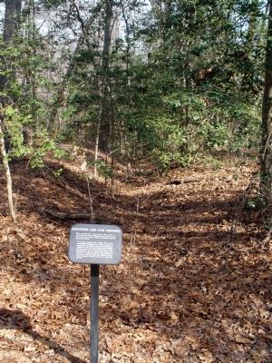
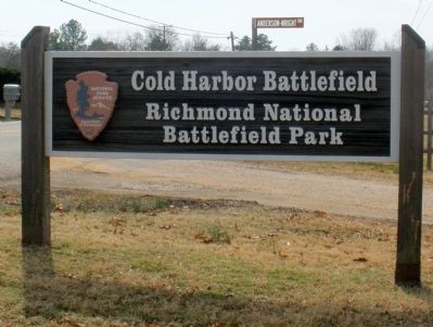
Location. 37° 35.271′ N, 77° 17.289′ W. Marker is near Mechanicsville, Virginia, in Hanover County. Marker can be reached from the intersection of Anderson-Wright Drive and Cold Harbor Road (Virginia Route 156). This marker is located along the walking trail in the Cold Harbor Battlefield Unit of the Richmond National Battlefield Park. Touch for map. Marker is at or near this postal address: 5515 Anderson-Wright Drive, Mechanicsville VA 23111, United States of America. Touch for directions.
Other nearby markers. At least 8 other markers are within walking distance of this marker. Those People Stand No Chance (a few steps from this marker); Nowhere To Go (within shouting distance of this marker); The Ultimate Sacrifice (about 300 feet away, measured in a direct line); The Waters Ran Red (about 400 feet away); A Lethal Occupation (about 500 feet away); Confederate Breastworks (about 700 feet away); Killing Fields (approx. 0.2 miles away); A Deadly Delay (approx. 0.2 miles away). Touch for a list and map of all markers in Mechanicsville.
Also see . . .
1. Richmond National Battlefield Park. Cold Harbor (Submitted on March 8, 2009, by Bernard Fisher of Richmond, Virginia.)
2. CWSAC Battle Summary. Cold Harbor (Submitted on March 8, 2009, by Bernard Fisher of Richmond, Virginia.)
3. Cold Harbor Battlefield Virtual Tour by Markers. This is one of the many markers along the walking trail, extended loop trail, and auto tour route in the Cold Harbor Battlefield Unit of the Richmond National Battlefield Park. (Submitted on March 9, 2009, by Bernard Fisher of Richmond, Virginia.)
Credits. This page was last revised on June 16, 2016. It was originally submitted on March 8, 2009, by Bernard Fisher of Richmond, Virginia. This page has been viewed 961 times since then and 15 times this year. Photos: 1, 2, 3. submitted on March 8, 2009, by Bernard Fisher of Richmond, Virginia.


