Hilltop in Columbus in Franklin County, Ohio — The American Midwest (Great Lakes)
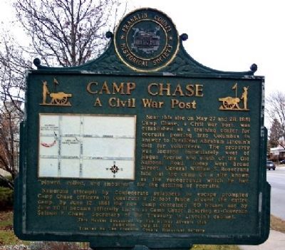
Camp Chase
A Civil War Post
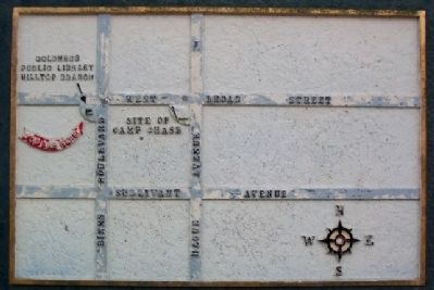
Near this site on May 27 and 28, 1861 Camp Chase, a Civil War post, was established as a training center for recruits pouring into Columbus in answer to President Abraham Lincoln's call for volunteers. The property was located immediately west of Hague Avenue and south of the Old National Road, today West Broad Street. General William S. Rosecrans laid out the camp on a site known as the racegrounds which he had “plowed, rolled, and smoothed” for the drilling of recruits.
Numerous attempts by Confederate prisoners to escape prompted Camp Chase officers to construct a 12-foot fence around the entire camp. By June 12, 1861 the new camp contained 160 houses and by June 20 it became officially known as Camp Chase, honoring ex-Governor Salmon P. Chase, Secretary of the Treasury in Lincoln's cabinet.
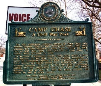
Side B:
The first Confederate prisoners arrived at Camp Chase from western Virginia, July 5, 1861. Within two weeks 4,200 rebel prisoners had been received at Camp Chase. During the early days of 1865 there were 7,000 prisoners at Camp Chase, a number which increased to 9,416.
In its years of government service Camp Chase served a four-fold purpose: It was first used as a training installation, a prison for Confederate captives, a place of detention for paroled Union soldiers and finally served as a mustering-out place for northern regiments. On July 5, 1865 the prison commandant notified the War Department that Camp Chase was without prisoners . . . and on July 14, 1865 the prison property was offered for sale at public auction.
Dedicated July 13, 1961
Erected by The Hilltop Kiwanis Club and The Franklin County Historical Society.
Topics. This historical marker is listed in these topic lists: Government & Politics • War, US Civil. A significant historical month for this entry is May 1869.
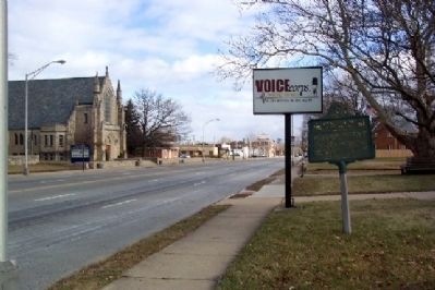
Location. 39° 57.275′ N, 83° 4.764′ W. Marker is in Columbus, Ohio, in Franklin County. It is in Hilltop. Marker is at the intersection of Broad Street (U.S. 40) and Binns Boulevard, on the right when traveling east on Broad Street. Touch for map. Marker is at or near this postal address: 2955 W Broad Street, Columbus OH 43204, United States of America. Touch for directions.
Other nearby markers. At least 8 other markers are within 2 miles of this marker, measured as the crow flies. A different marker also named Camp Chase (within shouting distance of this marker); Camp Chase Confederate Cemetery (approx. 0.8 miles away); This Confederate Cemetery (approx. 0.8 miles away); 2260 Confederate Soldiers (approx. 0.8 miles away); Confederate Cannonball (approx. 0.8 miles away); a different marker also named Camp Chase (approx. 0.8 miles away); The National Road (approx. 0.9 miles away); Maynard E. Sensenbrenner (approx. 1˝ miles away). Touch for a list and map of all markers in Columbus.
Also see . . . Camp Chase. Ohio History Central website entry (Submitted on March 11, 2009, by Craig Swain of Leesburg, Virginia.)
Credits. This page was last revised on February 3, 2023. It was originally submitted on March 11, 2009, by William Fischer, Jr. of Scranton, Pennsylvania. This page has been viewed 1,565 times since then and 13 times this year. Photos: 1, 2, 3, 4. submitted on March 11, 2009, by William Fischer, Jr. of Scranton, Pennsylvania. • Craig Swain was the editor who published this page.


