East Central in Fort Wayne in Allen County, Indiana — The American Midwest (Great Lakes)
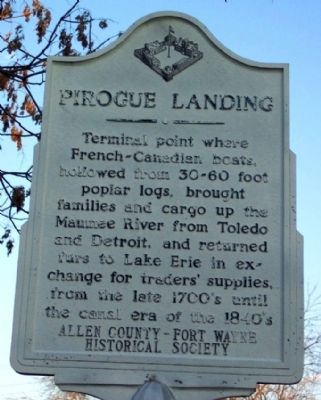
Pirogue Landing
Erected by Allen County - Fort Wayne Historical Society.
Topics. This historical marker is listed in these topic lists: Animals • Colonial Era • Exploration • Industry & Commerce • Settlements & Settlers • Waterways & Vessels.
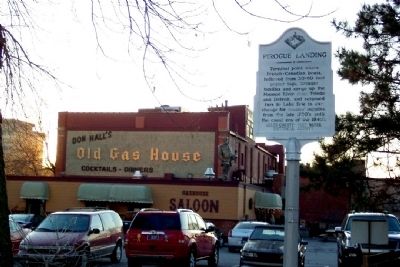
Location. 41° 4.997′ N, 85° 8.164′ W. Marker is in Fort Wayne, Indiana, in Allen County. It is in East Central. Marker is at the intersection of Superior Street and Spy Run Avenue / Purple Heart Memorial Hwy (U.S. 27), on the left when traveling east on Superior Street. Marker is just east of Don Hall's Old Gas House Restaurant. Touch for map. Marker is in this post office area: Fort Wayne IN 46802, United States of America. Touch for directions.
Other nearby markers. At least 8 other markers are within walking distance of this marker. Three Rivers Water Filtration Plant (about 500 feet away, measured in a direct line); The Nickel Plate Railroad (about 500 feet away); The Wabash And Erie Canal (about 500 feet away); Whistler's Fort (about 600 feet away); Reconstruction of Whistler's Fort (about 600 feet away); Takaoka and Fort Wayne Time Capsule (about 600 feet away); This Barr And Columbia Street Intersection (about 600 feet away); Barr And Columbia (about 600 feet away). Touch for a list and map of all markers in Fort Wayne.
Credits. This page was last revised on February 4, 2023. It was originally submitted on March 12, 2009, by William Fischer, Jr. of Scranton, Pennsylvania. This page has been viewed 2,190 times since then and 26 times this year. Photos: 1, 2. submitted on March 12, 2009, by William Fischer, Jr. of Scranton, Pennsylvania. • Bill Pfingsten was the editor who published this page.

