Colonial Heights, Virginia — The American South (Mid-Atlantic)
Fort Clifton
Guardian of the Appomattox
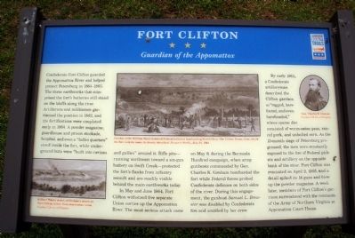
In May and June 1864, Fort Clifton withstood five separate Union sorties up the Appomattox River. The most serious attack came on May 9, during the Bermuda Hundred campaign, when army gunboats commanded by Gen. Charles K. Graham bombarded the fort while Federal forces probed Confederate defenses on both sides of the river. During this engagement, the gunboat Samuel L. Brewster was disabled by Confederate fire and scuttled by her crew.
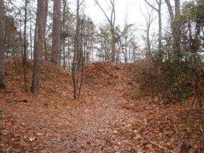
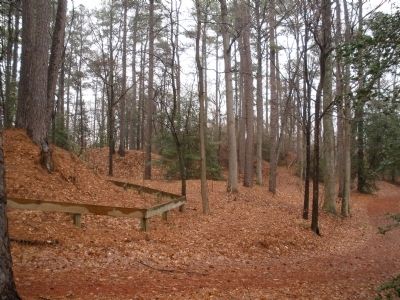
By early 1865, a Confederate artilleryman described the Clifton garrison as “ragged, barefooted, and even bareheaded,” whose sparse diet consisted of worm-eaten peas, rancid pork, and unbolted corn. As the 10-month siege of Petersburg progressed, the men were constantly exposed to the fire of Federal pickets and artillery on the opposite bank of the river. Fort Clifton was evacuated on April 2, 1865, and a detail spiked its 14 guns and blew up the powder magazine. A week later, members of Fort Clifton’s garrison surrendered with the remnants of the Army of Northern Virginia at Appomattox Court House.
Erected by Virginia Civil War Trails.
Topics and series. This historical marker is listed in these topic lists: Forts and Castles • War, US Civil. In addition, it is included in the Virginia Civil War Trails series list. A significant historical date for this entry is May 9, 1864.
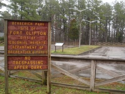
Location. 37° 16.838′ N, 77° 22.041′ W. Marker is in Colonial Heights, Virginia. Marker is on Brockwell Lane, 0.3 miles east of Conduit Road, in the median. This marker is in the parking lot of Berberich Park at the end of Brockwell Lane, behind Tussing Elementary School. Touch for map. Marker is in this post office area: Colonial Heights VA 23834, United States of America. Touch for directions.
Other nearby markers. At least 8 other markers are within 3 miles of this marker, measured as the crow flies. A different marker also named Fort Clifton (about 500 feet away, measured in a direct line); a different marker also named Fort Clifton (approx. ¼ mile away); The Brick House At Conjurer's Neck (approx. 0.3 miles away); The Old Brick (Kennon) House (approx. 0.3 miles away); Conjurer's Field Prehistoric Native American Village (approx. 0.3 miles away); Confederate Fortification (approx. half a mile away); Ellerslie (approx. 2.1 miles away); a different marker also named Ellerslie (approx. 2.1 miles away). Touch for a list and map of all markers in Colonial Heights.
More about this marker. On the lower left is “William Waud’s sketch of Graham’s attack on Fort Clifton, drawn from observation tower.” Courtesy Library of Congress
In the center is a sketch captioned, "Combat artist William Waud sketched Federal batteries bombarding Fort Clifton. The Clifton House, from which the fort took its name, is clearly identified. Harper’s Weekly, July 23, 1864."
On the upper right is a photo of “Gen. Charles K. Graham” Courtesy Library of Congress
Also see . . .
1. Fort Clifton. City of Colonial Heights (Submitted on March 16, 2009.)
2. Fort Clifton Archaeological Site. National Register of Historic Places (Submitted on March 16, 2009.)
Photographed By Bernard Fisher, March 15, 2009
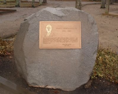
6. Tribute to John E. Brockwell, Jr. 1925 - 1993.
For his development and love of Fort Clifton; his founding of the Arts and Crafts festival; his leadership of the Colonial Heights Historical Society; and his love for the city of Colonial Heights, Va. From his friends May 1994.
Credits. This page was last revised on November 5, 2021. It was originally submitted on March 16, 2009, by Bernard Fisher of Richmond, Virginia. This page has been viewed 2,463 times since then and 43 times this year. Photos: 1, 2, 3, 4, 5, 6. submitted on March 16, 2009, by Bernard Fisher of Richmond, Virginia.
