Hiawatha in Minneapolis in Hennepin County, Minnesota — The American Midwest (Upper Plains)
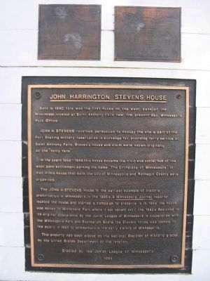
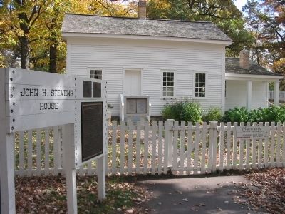
John Harrington Stevens House
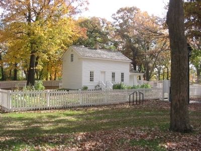
Built in 1850, this was the first house on the west bank of the Mississippi, located at Saint Anthony Falls near the present-day Minneapolis Post Office.
John H. Stevens received permission to occupy the site, a part of the Fort Snelling military reservation in exchange for providing ferry service at Saint Anthony Falls. Steven's house and claim were originally known as the "ferry farm."
In the years 1850 – 1855, this house became the civic and social hub of the west bank settlement, earning the name "The Birthplace of Minneapolis." It was in this house that both the city of Minneapolis and Hennepin County were organized.
The John H. Stevens House is the earliest example of historic preservation in Minneapolis. In the 1890s, a Minneapolis Journal reporter located the house and started a campaign to preserve it. In 1896 the house was moved to Minnehaha Park, where it sat vacant until the 1980s. Restored to its original appearance by the Junior League of Minneapolis in cooperation with the Minneapolis Park and Recreation Board, the Stevens house was opened to the public in 1985 to commemorate the early history of Minneapolis.
This property has been placed on the National Register of Historic places by the United States Department of the Interior.
Erected 1985 by the Junior League of Minneapolis.
Topics. This historical marker is listed in these topic lists: Settlements & Settlers • Waterways & Vessels. A significant historical year for this entry is 1850.
Location. 44° 54.837′ N, 93° 12.592′ W. Marker is in Minneapolis, Minnesota, in Hennepin County. It is in Hiawatha. Marker can be reached from Minnehaha Avenue south of East Minnehaha Parkway, on the left when traveling south. Marker is in Minnehaha Park. Touch for map. Marker is at or near this postal address: 4901 South Minnehaha Park Drive/Avenue, Minneapolis MN 55417, United States of America. Touch for directions.
Other nearby markers. At least 8 other markers are within walking distance of this marker. Col. John H. Stevens (a few steps from this marker); Gunnar Wennerberg (within shouting distance of this marker); Stevens House (within shouting distance of this marker); Minnehaha Depot (about 400 feet away, measured in a direct line); 3 – Master Map (about 400 feet away); Geology of Minnesota (about 500 feet away); 1–Main Entrance Minnehaha Lower Glen (about 500 feet away); President Lyndon B. Johnson (about 700 feet away). Touch for a list and map of all markers in Minneapolis.
Also see . . . John H. Stevens House. (Submitted on March 22, 2009.)
Credits. This page was last revised on February 12, 2023. It was originally submitted on March 22, 2009, by Keith L of Wisconsin Rapids, Wisconsin. This page has been viewed 1,679 times since then and 212 times this year. Photos: 1, 2, 3. submitted on March 22, 2009, by Keith L of Wisconsin Rapids, Wisconsin. • Kevin W. was the editor who published this page.


