Statham in Barrow County, Georgia — The American South (South Atlantic)
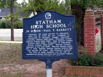
Statham High School
In Honor - Paul T. Barrett
Erected 1978 by Students and Friends of Paul T. Barrett.
Topics. This historical marker is listed in these topic lists: Churches & Religion • Education. A significant historical month for this entry is February 1619.
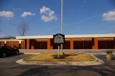
Location. 33° 57.846′ N, 83° 35.538′ W. Marker is in Statham, Georgia, in Barrow County. Marker is on Broad Street, 0 miles east of Elizabeth Street, on the left when traveling east. Marker is located in front of Statham Elementary School. Touch for map. Marker is at or near this postal address: 1970 Broad Street, Statham GA 30666, United States of America. Touch for directions.
Other nearby markers. At least 8 other markers are within 7 miles of this marker, measured as the crow flies. First Georgia Chapter Future Farmers of America (within shouting distance of this marker); a different marker also named First Georgia Chapter Future Farmers of America (approx. 0.2 miles away); Statham House (approx. 0.2 miles away); B.C. Hogan (approx. 3.7 miles away); William Pentecost (approx. 3.9 miles away); Russell House (approx. 6˝ miles away); Wheat House (approx. 6.8 miles away); Milking Barn (approx. 6.8 miles away). Touch for a list and map of all markers in Statham.
Credits. This page was last revised on January 3, 2020. It was originally submitted on March 26, 2009, by David Seibert of Sandy Springs, Georgia. This page has been viewed 1,459 times since then and 51 times this year. Photos: 1, 2, 3. submitted on March 26, 2009, by David Seibert of Sandy Springs, Georgia. • Craig Swain was the editor who published this page.


