Jamestown in James City County, Virginia — The American South (Mid-Atlantic)
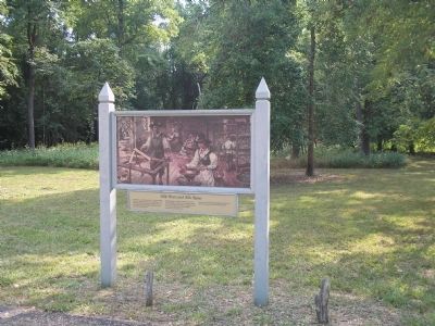
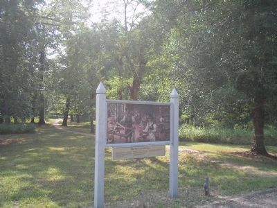
Silk Worn and Silk Spun
Spinning fibers from the silkworm cocoon was a lengthy, smelly chore. Despite orders from the Virginia Company to produce silk as a staple commodity, the colonists preferred to raise tobacco.
Jamestown silk, like Jamestown wine, was not the hoped-for New World treasure.
Erected by Colonial National Historic Park.
Topics. This historical marker is listed in this topic list: Colonial Era. A significant historical year for this entry is 1619.
Location. 37° 12.233′ N, 76° 44.904′ W. Marker is in Jamestown, Virginia, in James City County. Marker is on Loop Drive, on the left when traveling west. Marker is on Jamestown Island, along the Loop Drive. Touch for map. Marker is in this post office area: Jamestown VA 23081, United States of America. Touch for directions.
Other nearby markers. At least 8 other markers are within walking distance of this marker. Bowl, Pot, and Pipe (approx. 0.2 miles away); Virginia’s Vintage (approx. 0.2 miles away); The Golden Weed (approx. 0.4 miles away); Early Medical Discoveries (approx. 0.4 miles away); The “Island House” (approx. half a mile away); A Site of Habitation (approx. 0.6 miles away); Iron for Corn (approx. 0.6 miles away); Harvesting Ice (approx. 0.7 miles away). Touch for a list and map of all markers in Jamestown.
More about this marker. The top of the marker features a picture of Jamestown colonists spinning silk inside their home.
Related markers. Click here for a list of markers that are related to this marker. Take a virtual tour of markers located along the Loop Drive on Jamestown Island.
Also see . . .
1. Island Loop Drive. Colonial National Historic Park from National Park Service website. (Submitted on March 27, 2009, by Bill Coughlin of Woodland Park, New Jersey.)
2. Historic Jamestowne. Historic Jamestowne is the site of the first permanent English settlement in America. The site is jointly administered by APVA Preservation Virginia and the National Park Service. (Submitted on March 27, 2009, by Bill Coughlin of Woodland Park, New Jersey.)
Credits. This page was last revised on June 16, 2016. It was originally submitted on March 27, 2009, by Bill Coughlin of Woodland Park, New Jersey. This page has been viewed 854 times since then and 8 times this year. Photos: 1, 2, 3, 4. submitted on March 27, 2009, by Bill Coughlin of Woodland Park, New Jersey.


