Cumberland Township near Round Top in Adams County, Pennsylvania — The American Northeast (Mid-Atlantic)
End of the Second Day
July 2, 1863 - Second Day
"The great Rebel assault, the greatest ever made upon this continent, had been made and signally repulsed...."
1st Lt. Frank A. Haskell, U.S.A.
Aide to Brig. Gen. John Gibbon.
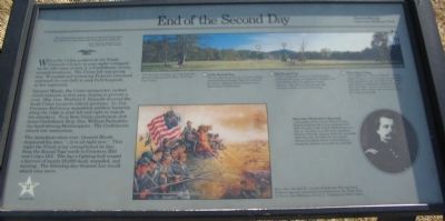
When the Union position at the Peach Orchard (1/2 mile to your right) collapsed on the afternoon of July 2, a Confederate victory seemed imminent. The Union left was giving way. Wounded and retreating Federals streamed eastward (to your left) to seek field hospitals or lost regiments.
General Meade, the Union commander, rushed reinforcements to this area, hoping to prevent a rout. Maj. Gen. Winfield S. Hancock directed the fresh Union troops to critical positions. Lt. Col. Freeman McGilvery assembled artillery batteries along the ridge to your left and right to impede the attackers. Near here Union marksmen shot down Confederate Brig. Gen. William Barksdale, the hard-driving Mississippian. The Confederate attack lost momentum.
The immediate crisis over, General Meade reassured his men, "...it is all right now." That night the Union army strengthened its line from the Round Tops north to Cemetery Hill and Culp's Hill. The day's fighting had reaped a harvest of nearly 20,000 dead, wounded, and missing. The following day General Lee would attack once more.
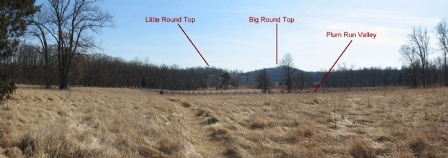
(Key to Panorama in the Upper Center and Right):
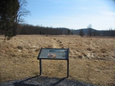
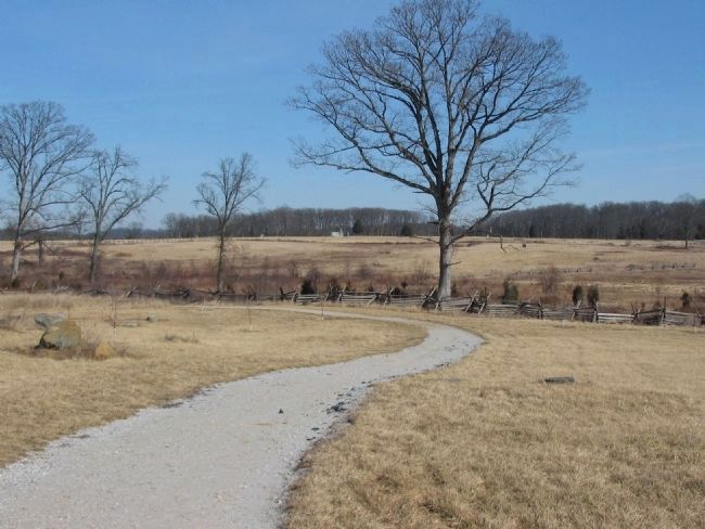
You are now standing on United States Avenue looking south down the Plum Run Valley.
(1) Little Round Top
On the afternoon of July 2 Union troops reached this strategic high ground just in time to defend it from Longstreet's attacking Confederates.
(2) Big Round Top
On the afternoon of July 2 Confederates of Hood's Division occupied the summit, but were driven off that night by Union infantry. Big Round Top became the southern anchor of the Union line.
(3) Plum Run Valley
Also called "Valley of Death." On the night of July 2 Union troops occupied the high ground on the left side of the valley, opposed by Confederate skirmishers on the right sided. In the "no man's land" between the armies, the wounded cried for help in the dark.
Erected by Gettysburg National Military Park.
Topics. This historical marker is listed in this topic list: War, US Civil. A significant historical date for this entry is July 2, 1863.
Location. This marker has been replaced by another marker nearby. It was located near 39° 48.114′ N, 77° 14.35′ W. Marker was near Round Top, Pennsylvania, in Adams County. It was in Cumberland Township. Marker was on United States Avenue, on the right when traveling east. Located near the Trostle Farm in Gettysburg National
Military Park. Touch for map. Marker was in this post office area: Gettysburg PA 17325, United States of America. Touch for directions.
Other nearby markers. At least 8 other markers are within walking distance of this location. A Costly Day (within shouting distance of this marker); Battery I, Fifth U.S. Artillery (about 500 feet away, measured in a direct line); 39th New York Infantry (about 500 feet away); 150th New York Infantry (approx. 0.2 miles away); Ninth Massachusetts Battery (approx. 0.2 miles away); Major General Sickles (approx. 0.2 miles away); Unflinching Under Fire (approx. 0.2 miles away); 3d Corps Headquarters (approx. 0.2 miles away).
More about this marker. In the upper center and right is a panoramic view, looking south, of the valley. In the lower center is a painting depicting some of the action near the close of the Second Day. Brig. Gen. Samuel W. Crawford leads the Pennsylvania Reserves against attacking Confederates in the Plum Run Valley on the afternoon of July 2. Painting by Dale Gallon.
On the right is a portrait of Maj. Gen. Winfield S. Hancock, commander of the Union Second Corps, helped stabilize the Union position here after the fall of the Peach Orchard line on July 2. On July 3, as his men repulsed Pickett's Charge, he was severely wounded. After the war, in 1880, he was nearly elected President of the United States losing the election to James A. Garfield.
Related marker. Click here for another marker that is related to this marker. New Marker At This Location titled "A Costly Day".
Also see . . . Haskell's Account of the Battle of Gettysburg. Lt. Haskell wrote this account of the battle, from which the leading quote is taken. (Submitted on March 29, 2009, by Craig Swain of Leesburg, Virginia.)
Photographed By Craig Swain, February 21, 2009
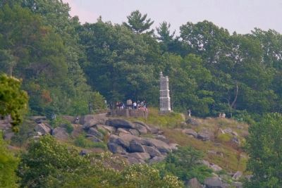
5. Federal Center and McGilvery's Line
Looking from the Trostle Farm east toward Cemetery Ridge. Almost center of the view is the New York Auxiliary Memorial on Hancock Avenue, on top of the ridge. McGilvery, as mentioned on the marker, placed his surviving artillery, and any additional reinforcements he could bring in, along the high ground overlooking Plum Run.
Credits. This page was last revised on February 7, 2023. It was originally submitted on March 29, 2009, by Craig Swain of Leesburg, Virginia. This page has been viewed 1,223 times since then and 12 times this year. Photos: 1. submitted on March 29, 2009, by Craig Swain of Leesburg, Virginia. 2. submitted on August 27, 2011, by Henry T. McLin of Hanover, Pennsylvania. 3, 4, 5. submitted on March 29, 2009, by Craig Swain of Leesburg, Virginia.
