Near Algoma in Kewaunee County, Wisconsin — The American Midwest (Great Lakes)
The Kewaunee County Piers
Inscription.
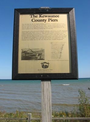
This was once the site of a small, bustling, waterfront community typical of many others in Kewaunee County. By the mid-1800's, as large numbers of settlers moved into the rural areas of the newly formed county, efficient transportation became a necessity. Since an overland transportation system was practically nonexistent, the settlers turned to Lake Michigan and the Bay of Green Bay.
Numerous piers were constructed along the shoreline with stores, sawmills, blacksmith shops, hotels, post offices, cheese factories, and other business enterprises as well as residential dwellings and warehouses. Sailboats and steamers transported forest products and later agricultural products to markets in Green Bay, Milwaukee, and Chicago. Incoming ships brought needed goods as well as passengers and news from the outside world. Gradually, as roads and railroad lines were constructed and with the advent of automobiles and trucks, the piers ceased to be needed. For a time, remnants were visible, but over the years, they too have virtually disappeared.
Erected 1999 by the Kewaunee County Historical Society.
Topics. This historical marker is listed in these topic lists: Settlements & Settlers • Waterways & Vessels.
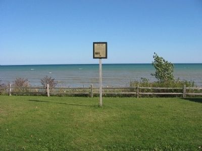
Location. 44° 33.947′ N, 87° 27.485′ W. Marker is near Algoma, Wisconsin, in Kewaunee County. Marker is on Lakeshore Drive (State Highway 42) south of Ninth Road, on the left when traveling south. Touch for map. Marker is in this post office area: Algoma WI 54201, United States of America. Touch for directions.
Other nearby markers. At least 8 other markers are within 4 miles of this marker, measured as the crow flies. Brickyards (approx. 2.6 miles away); The Church of St. Agnes-by-the-Lake (approx. 2.9 miles away); Door-Kewaunee County College / Henry Diefenbach Sculptures (approx. 3 miles away); Bruemmerville (approx. 3 miles away); American Legion Park (approx. 3 miles away); The Kewaunee County Farm (approx. 3.1 miles away); Christmas Tree Ship Point (approx. 3.2 miles away); Schooner Daniel Lyons (approx. 3.2 miles away). Touch for a list and map of all markers in Algoma.
Also see . . . Kewaunee County Historical Society. (Submitted on March 31, 2009.)
Credits. This page was last revised on June 16, 2016. It was originally submitted on March 30, 2009, by Keith L of Wisconsin Rapids, Wisconsin. This page has been viewed 1,131 times since then and 48 times this year. Photos: 1, 2. submitted on March 30, 2009, by Keith L of Wisconsin Rapids, Wisconsin. 3. submitted on December 14, 2010, by Bob (peach) Weber of Dewey, Arizona. • Craig Swain was the editor who published this page.


