King-Lincoln Bronzeville in Columbus in Franklin County, Ohio — The American Midwest (Great Lakes)
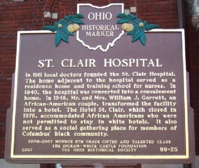
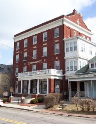
St. Clair Hospital
Erected 2007 by 2006-2007 Monroe 8th Grade Gifted and Talented Class, The Ingram-White Castle Foundation, and The Ohio Historical Society. (Marker Number 99-25.)
Topics and series. This historical marker is listed in these topic lists: African Americans • Charity & Public Work • Civil Rights • Entertainment • Science & Medicine. In addition, it is included in the Ohio Historical Society / The Ohio History Connection series list. A significant historical year for this entry is 1911.
Location. 39° 58.306′ N, 82° 58.846′ W. Marker is in Columbus, Ohio, in Franklin County. It is in King-Lincoln Bronzeville. Marker is on St. Clair Avenue, on the right when traveling north. Touch for map. Marker is at or near this postal address: 346 St Clair Avenue, Columbus OH 43203, United States of America. Touch for directions.
Other nearby markers. At least 8 other markers are within walking distance of this marker. Shiloh Baptist Church (about 600 feet away, measured in a direct line); Second Baptist Church / James P. Poindexter (approx. 0.3 miles away); The Lincoln Theatre (approx. 0.3 miles away); Mount Vernon Avenue (approx. 0.4 miles away); King Lincoln District Arch (approx. 0.4 miles away); St. Paul African Methodist Episcopal Church (approx. 0.4 miles away); James Thurber (approx. half a mile away); Donn Vickers Gazebo in Thurber Park (approx. half a mile away). Touch for a list and map of all markers in Columbus.
Credits. This page was last revised on February 3, 2023. It was originally submitted on March 30, 2009, by William Fischer, Jr. of Scranton, Pennsylvania. This page has been viewed 2,287 times since then and 57 times this year. Photos: 1, 2. submitted on March 30, 2009, by William Fischer, Jr. of Scranton, Pennsylvania. • Christopher Busta-Peck was the editor who published this page.

