Woodbury Center in Litchfield County, Connecticut — The American Northeast (New England)
Woodbury
Inscription.
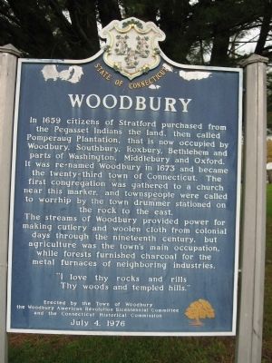
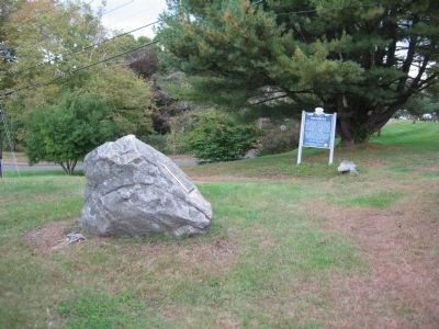
In 1659 citizens of Stratford purchased from the Pegasset Indians the land, then called Pomperaug Plantation, that is now occupied by Woodbury, Southbury, Roxbury, Bethlehem and parts of Washington, Middlebury and Oxford. It was re-named Woodbury in 1673 and became the twenty-third town of Connecticut. The first congregation was gathered to a church near this marker, and townspeople were called to worship by the town drummer stationed on the rock to the east.
The streams of Woodbury provided power for making cutlery and woolen cloth from colonial days through the nineteenth century, but agriculture was the town’s main occupation, while forests furnished charcoal for the metal furnaces of neighboring industries.
“I love the rocks and rills
Thy woods and templed hills.”
Erected 1976 by Town of Woodbury, Woodbury American Revolution Bicentennial Committee, Connecticut Historical Commission.
Topics. This historical marker is listed in these topic lists: Colonial Era • Political Subdivisions • Settlements & Settlers. A significant historical year for this entry is 1659.
Location. 41° 32.263′ N, 73° 12.433′ W. Marker is in Woodbury, Connecticut, in Litchfield County. It is in Woodbury Center. Marker is at the intersection of Main Street South (U.S. 6) and Park Road, on the left when traveling north on Main Street South. Across Main Street from the Woodbury Civil War Monument. Touch for map. Marker is in this post office area: Woodbury CT 06798, United States of America. Touch for directions.
Other nearby markers. At least 8 other markers are within walking distance of this marker. The Common (a few steps from this marker); Soldiers' Memorial (within shouting distance of this marker); Woodbury Vietnam Era Monument (within shouting distance of this marker); Woodbury World War II Memorial (within shouting distance of this marker); Woodbury Korean Conflict Monument (within shouting distance of this marker); Woodbury World War I Memorial (within shouting distance of this marker); Liberty Tree Memorial (about 300 feet away, measured in a direct line); District No. 2 Schoolhouse (about 400 feet away). Touch for a list and map of all markers in Woodbury.
Credits. This page was last revised on February 10, 2023. It was originally submitted on April 3, 2009, by Michael Herrick of Southbury, Connecticut. This page has been viewed 1,705 times since then and 34 times this year. Photos: 1, 2. submitted on April 3, 2009, by Michael Herrick of Southbury, Connecticut. • Kevin W. was the editor who published this page.

