Near Marietta in Cobb County, Georgia — The American South (South Atlantic)
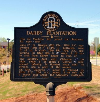
Darby Plantation
June 17-19. Geary’s (2d) Div., 20th A.C., supporting 13th N.Y. & Pa. E batteries, were N. of rd. & Cox’s (3d) Div. 23d. A.C., supporting 1st Ohio Bat. D. [US] were S. of rd. -- in area from Darby house to Mud Cr.
The artillery duel with Cleburne [CS] on high ridge E. of creek & Geary’s [US] rain-soaked infantry in flooded area next to stream, are a part of the annals.
On 19th, Cleburne [CS] moved E. followed by 20th A.C. 23d A.C. moved S. on this rd. -- a march that broke the Kennesaw stalemate.
Erected 1952 by Georgia Historical Commission. (Marker Number 033-7.)
Topics and series. This historical marker is listed in this topic list: War, US Civil. In addition, it is included in the Georgia Historical Society series list. A significant historical month for this entry is June 1754.
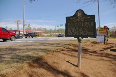
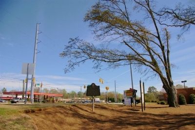
Location. 33° 57.167′ N, 84° 38.967′ W. Marker is near Marietta, Georgia, in Cobb County. Marker is at the intersection of Marietta Highway (Georgia Route 120) and Bob Cox Road, on the right when traveling east on Marietta Highway. Marker is at entrance to shopping center opposite Bob Cox Road. Touch for map. Marker is in this post office area: Marietta GA 30064, United States of America. Touch for directions.
Other nearby markers. At least 8 other markers are within 2 miles of this marker, measured as the crow flies. Old Sandtown Road (approx. ¼ mile away); Green Plantation (approx. ¾ mile away); Mud Creek Line (approx. 0.9 miles away); Due West Community (approx. 1½ miles away); Battle of Gilgal Church (approx. 1½ miles away); Military Action at Gilgal Church (approx. 1½ miles away); Battle of Pine Knob (approx. 1.6 miles away); The Reversed Trench (approx. 1.7 miles away). Touch for a list and map of all markers in Marietta.
More about this marker. Marker originally stood approximately 1/10 mile east on Ga 120, in front of the Darby house.
Photographed By David Seibert, April 4, 2009
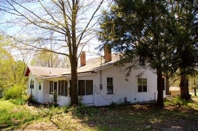
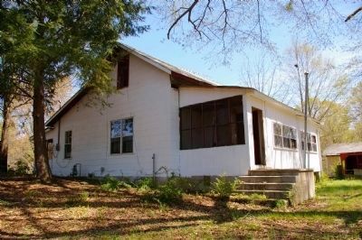
4. Darby Plantation
This is the original front. The house has been extensively remodeled since the Civil War. The porch is a later addition, probably in the first third of the 20th century. The wing to the back was probably built at the same time. The window on the second floor appears to be original, while the ones on the first floor were probably added at the same time as the rear addition.
Credits. This page was last revised on June 16, 2016. It was originally submitted on April 5, 2009, by David Seibert of Sandy Springs, Georgia. This page has been viewed 1,942 times since then and 60 times this year. Photos: 1, 2, 3, 4, 5. submitted on April 5, 2009, by David Seibert of Sandy Springs, Georgia. • Craig Swain was the editor who published this page.
