Buckhead in Atlanta in Fulton County, Georgia — The American South (South Atlantic)
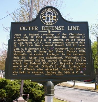
Outer Defense Line
July 20. After line adjustment, Walthall’s div., astride Howell Mill Rd., moved N. (about 4 P.M.) to attack the Federal 20th A. C.; Reynolds’ brigade was W. of the rd., O’Neal’s east of it. Loring’s div. (E. of O’Neal) also attacked. French’s div. [CS] was held in reserve, facing the 14th A. C. [US].
Erected 1955 by Georgia Historical Commission. (Marker Number 060-50.)
Topics and series. This historical marker is listed in this topic list: War, US Civil. In addition, it is included in the Georgia Historical Society series list. A significant historical date for this entry is July 17, 1757.
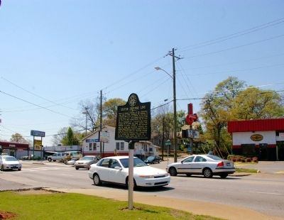
Location. 33° 48.09′ N, 84° 24.925′ W. Marker is in Atlanta, Georgia, in Fulton County. It is in Buckhead. Marker is at the intersection of Howell Mill Road and White Street, on the right when traveling north on Howell Mill Road. Touch for map. Marker is in this post office area: Atlanta GA 30318, United States of America. Touch for directions.
Other nearby markers. At least 8 other markers are within walking distance of this marker. French’s Division Hood’s Left Flank (approx. 0.4 miles away); The Hiram Embry Plantation (approx. half a mile away); Reynolds’ Brigade at the Ravine (approx. 0.6 miles away); Maj. William C. Preston C.S.A (approx. 0.6 miles away); Old Mt. Zion Church (approx. 0.6 miles away); Geary’s Refused Line (approx. ¾ mile away); O’Neal’s Brigade (approx. ¾ mile away); Loring’s Hill (approx. ¾ mile away). Touch for a list and map of all markers in Atlanta.
Credits. This page was last revised on February 8, 2023. It was originally submitted on April 8, 2009, by David Seibert of Sandy Springs, Georgia. This page has been viewed 1,036 times since then and 24 times this year. Photos: 1, 2, 3. submitted on April 8, 2009, by David Seibert of Sandy Springs, Georgia. • Craig Swain was the editor who published this page.


