Cumberland in Allegany County, Maryland — The American Northeast (Mid-Atlantic)
Cumberland Gateway Westward
— Fort Cumberland Trail —
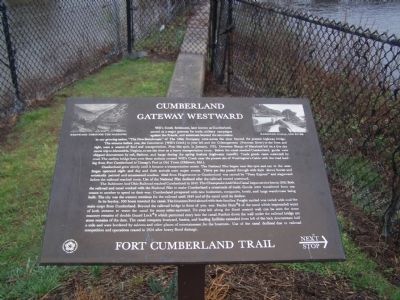
The streams before you, the Caiuctucuc (Wills Creek) to your left and the Cohongaronta (Potomac River) to the front and right, were a source of food and transportation. Near this spot, in January, 1755, Governor Sharpe of Maryland left on a five day canoe trip to Alexandria, Virginia, to test the river as a heavy transportation route. Before the canal reached Cumberland, goods were shipped downstream by raft, flatboat, and barge during the spring freshets (highwater runoffs). trade goods came westward by road. The earliest bridge here over these streams crossed Will's Creek near the present site of Washington's Cabin with the road leading from Fort Cumberland to Cresap's Fort at Old Town (Oldtown, Md.)
Cumberland grew slowly until it became a transportation center. The National Pike began near this spot and ran to the west. Stages operated night and day and their arrivals were major events. Thirty per day passed through with their showy horses and artistically painted and ornamented coaches. Mail from Hagerstown to Cumberland was carried by "Pony Express" and stagecoach before the railroad reached town. Use of the National Pike declined after the railroad moved westward.
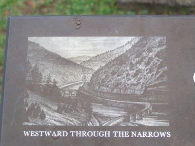
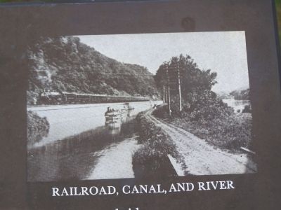
The Baltimore and Ohio Railroad reached Cumberland in 1842. The Chesapeake and Ohio Canal began service here in 1850. Both the railroad and canal worked with the National Pike to make Cumberland a crossroads of trade. Goods were transferred from one means to another to speed on their way. Cumberland prospered with new businesses, companies, hotels, and large warehouses being built. The city was the western terminus for the railroad until 1849 and of the canal until its decline.
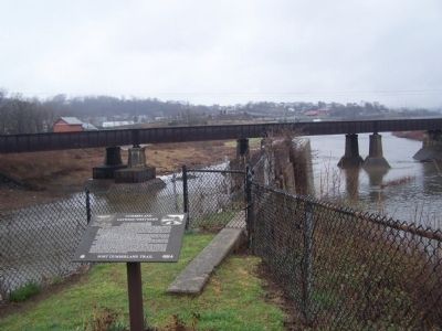
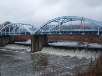
In its heyday, 500 boats traveled the canal. The boatmen lived aboard with their families. Freight carried was varied with coal the mail cargo from Cumberland. Beyond the railroad bridge in front of you was Feeder Dam #8 of the canal which impounded water of both streams to water the canal for many miles eastward. To your left along the flood control wall can be seen the stone masonry remains of double Guard Lock #8 which permitted entry into the canal. Further down the wall under the railroad bridge are stone remains of the dam. The canal company boatyard, basins, and loading facilities extended from left of the lock downstream half a mile and were bordered by saloons and other places of entertainment for the boatmen. Use of the canal declined due to railroad competition and operations ceased in 1924 after heavy flood damage.
Fort Cumberland Trail
Topics and series. This historical marker is listed in these topic lists: Bridges & Viaducts • Railroads & Streetcars • Roads & Vehicles • Waterways & Vessels. In addition, it is included in the Baltimore and Ohio Railroad (B&O), the Chesapeake and Ohio (C&O) Canal, and the The Historic National Road series lists. A significant historical month for this entry is January 1755.
Location. 39° 38.92′ N, 78° 45.892′ W. Marker is in Cumberland, Maryland, in Allegany County. Marker can be reached from Greene St.. Marker is in Riverside Park. Touch for map. Marker is in this post office area: Cumberland MD 21502, United States of America. Touch for directions.
Other nearby markers. At least 8 other markers are within walking distance of this marker. Palisado Fort or Stockade (within shouting distance of this marker); Our Local Indian Heritage (within shouting distance of this marker); Col. Joshua Fry (about 300 feet away, measured in a direct line); George Washington at Will’s Creek (about 300 feet away); Headquarters of George Washington (about 300 feet away); Beginning Of National Pike (about 400 feet away); The Old National Pike (about 400 feet away); Where the Road Began (about 400 feet away). Touch for a list and map of all markers in Cumberland.
Credits. This page was last revised on June 16, 2016. It was originally submitted on April 9, 2009, by Bill Pfingsten of Bel Air, Maryland. This page has been viewed 2,144 times since then and 43 times this year. Photos: 1, 2, 3, 4, 5. submitted on April 9, 2009, by Bill Pfingsten of Bel Air, Maryland.
