Marker Logo HMdb.org THE HISTORICAL
MARKER DATABASE
“Bite-Size Bits of Local, National, and Global History”
Mangohick in King William County, Virginia — The American South (Mid-Atlantic)
 

Mangohick Church


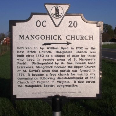
Mangohick Church Marker image. Click for full size.
Photographed By Bernard Fisher, April 9, 2009
1. Mangohick Church Marker
Inscription. Referred to by William Byrd in 1732 as the New Brick Church, Mangohick Church was built circa 1730 as a chapel of ease for those who lived in remote areas of St. Margaret's Parish. Distinguished by its fine Flemish bond brickwork, Mangohick became the Upper Church of St. David's when that parish was formed in 1774. It became a free church for use by any denomination following disestablishment of the Church of England in Virginia. It now serves the Mangohick Baptist congregation.
 
Erected 1985 by Department of Conservation and Historic Resources. (Marker Number OC-20.)
 
Topics and series. This historical marker is listed in this topic list: Churches & Religion. In addition, it is included in the Virginia Department of Historic Resources (DHR) series list. A significant historical year for this entry is 1732.
 
Location. 37° 48.602′ N, 77° 16.391′ W. Marker is in Mangohick, Virginia, in King William County. Marker is at the intersection of King William Road (Virginia Route 30) and Mangohick Church Road, on the left when traveling east on King William Road. Touch for map. Marker is in this post office area: Aylett VA 23009, United States of America. Touch for directions.
 
Other nearby markers. At least 8 other markers are within 6 miles of this marker, measured as the crow flies. Caroline County / King William County (approx. 2.4 miles away); Gabriel’s Rebellion
Paid Advertisement
Click on the ad for more information.
Please report objectionable advertising to the Editor.
Click or scan to see
this page online
(approx. 5.4 miles away); Caroline County / Hanover County (approx. 5˝ miles away); Patrick Henry (approx. 6 miles away); Hanover Courthouse (approx. 6.1 miles away); a different marker also named Hanover Courthouse (approx. 6.1 miles away); Hanover Confederate Soldiers Monument (approx. 6.1 miles away); The Fields Family (approx. 6.1 miles away).
 
Also see . . .  Mangohick Church. National Register of Historic Places (Submitted on April 10, 2009.) 
 
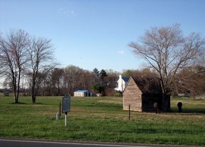
Mangohick Church Marker on King William Road image. Click for full size.
Photographed By Bernard Fisher, April 9, 2009
2. Mangohick Church Marker on King William Road
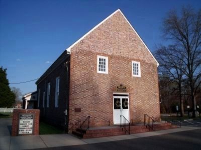
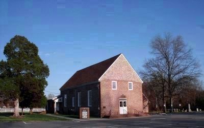
Mangohick Church established 1732. image. Click for full size.
Photographed By Bernard Fisher, April 9, 2009
3. Mangohick Church established 1732.
Army of the Potomac Headquarters. image. Click for full size.
Photographed By Bernard Fisher, April 9, 2009
4. Army of the Potomac Headquarters.
Generals Grant and Meade established army headquarters here on the night of May 27, 1864, as the army moved from the North Anna River to the Pamunkey River. Union soldiers camped in the surrounding area.
 
 
Credits. This page was last revised on November 9, 2021. It was originally submitted on April 10, 2009, by Bernard Fisher of Richmond, Virginia. This page has been viewed 1,737 times since then and 68 times this year. Photos:   1, 2, 3, 4. submitted on April 10, 2009, by Bernard Fisher of Richmond, Virginia.
Share this page.  
Share on Tumblr
m=17790

CeraNet Cloud Computing sponsors the Historical Marker Database.
This website earns income from purchases you make after using our links to Amazon.com. We appreciate your support.
Paid Advertisement
Apr. 23, 2024