Near Donalsonville in Seminole County, Georgia — The American South (South Atlantic)
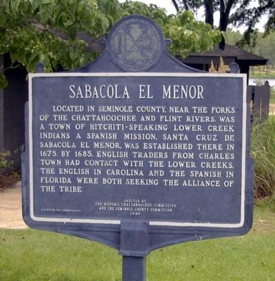
Sabacola El Menor
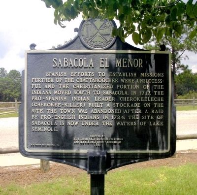
Reverse side:
Spanish efforts to establish missions further up the Chattahoochee were unsuccessful and the Christianized portion of the Indians moved south to Sabacola. In 1717, the pro-Spanish Indian leader Cherokeeleche (Cherokee-killer) built a stockade on the site. The town was abandoned after a raid by pro-English Indians in 1724. The site of Sabacola is now under the waters of Lake Seminole.
Erected 1980 by The Historic Chattahoochee Commission and the Seminole County Commission.
Topics. This historical marker is listed in these topic lists: Native Americans • Settlements & Settlers • War, French and Indian. A significant historical year for this entry is 1675.
Location. 30° 48.351′ N, 84° 52.582′ W. Marker is near Donalsonville, Georgia, in Seminole County. Marker is on State Park Drive, 0.1 miles south of Georgia Route 253, on the right when traveling east. Touch for map. Marker is at or near this postal address: 7870 State Park Dr, Donalsonville GA 39845, United States of America. Touch for directions.
Other nearby markers. At least 8 other markers are within 8 miles of this marker, measured as the crow flies. Apalachicola Arsenal (approx. 7.2 miles away in Florida); Victory Bridge (approx. 7.3 miles away in Florida); Site of Ellicott's Observatory (approx. 7.4 miles away in Florida); Ellicott's Camp and Observatory (approx. 7.4 miles away in Florida); The Chattahoochee Landing Mound Group (approx. 7.4 miles away in Florida); Nicoll's Outpost (approx. 7.4 miles away in Florida); The Scott Massacre (approx. 7.4 miles away in Florida); The Scott Battle of 1817 (approx. 7.4 miles away in Florida).
Credits. This page was last revised on July 21, 2016. It was originally submitted on April 11, 2009, by David Seibert of Sandy Springs, Georgia. This page has been viewed 1,884 times since then and 93 times this year. Photos: 1, 2. submitted on April 11, 2009, by David Seibert of Sandy Springs, Georgia. • Bill Pfingsten was the editor who published this page.
Editor’s want-list for this marker. A wide shot of the marker and its surroundings. • Can you help?

