Orwell in Addison County, Vermont — The American Northeast (New England)
Officers Quarters – 1776
Mount Independence State Historic Site
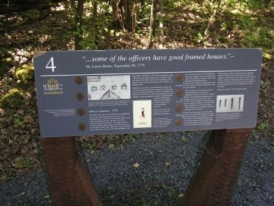
“ . . . some of the officers have good framed houses.” -
Dr. Lewis Beebe, September 30, 1776
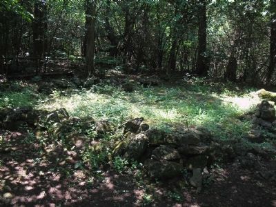
This fifteen-foot square, well-defined stone foundation may be the remains of quarters for one or more American officers in the Second Brigade, a unit of regiments from Massachusetts and New Hampshire encamped here the last half of 1776. Many soldiers arriving at Mount Independence after the retreat from Canada had lost their tents. Their first order of business was to clear trees and brush from the encampment site. Regulations stipulated a well laid-out regimental camp, with housing for enlisted men along company streets and quarters for officers in the rear. Lieutenants and captains were closest to the men and the colonels were furthest away.
Rank had its privilege in determining how many officers lived in each hut and in the amount of rations they received. Colonels, lieutenant colonels, and majors usually lived by themselves and were issued more food and supplies. Surgeons, adjutants, captains, and lieutenants may have shared their housing in pairs. Officer servants prepared the meals in separate structures.
Most of the wood came from the site and was hand-hewn or perhaps sawn in the mill at Fort Ticonderoga. The army supplied nails and window glass that were purchased in Albany, New York, shipped up the Hudson River to Skenesborough, and then transported on Lake Champlain or Lake George to Mount Independence and Fort Ticonderoga.
The construction of housing for officers and the enlisted men was similar. Zephaniah Shepardson from Col. Timothy Bedell’s New Hampshire Regiment, part of this Brigade, built his hut on July 30, 1776. “Our house I built. [For] my part [I] cut and laid up the logs and split basswoodlogs for the door and floor, civerd the roof with bas bark and made a fireplace of stone. Here I blistered my hands in this building.”
This hut and others in the area likely had a fireplace and chimney and sufficient headroom to stand upright. Archaeological investigations in 1989 and 1990 of several probable officer structures found artifacts indicating differences between the enlisted men and their officers, who generally were from wealthier civilian backgrounds and better-paying occupations. Shards of window glass reveal that officer huts had windows, while enlisted men’s quarters usually did not. Officers had better quality possessions, such as more expensive stoneware and creamware ceramic tableware, and wine glasses that reveal the drinking of costlier benerages.
Respect our history. Take only photographs.
Erected by Mount Independence State Historic Site.
Topics. This historical marker
is listed in this topic list: War, US Revolutionary. A significant historical month for this entry is July 1865.
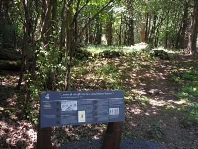
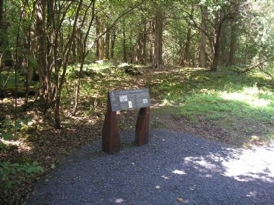
Location. 43° 49.641′ N, 73° 23.032′ W. Marker is in Orwell, Vermont, in Addison County. Marker can be reached from Mount Independence Road, on the right when traveling south. Marker is along the walking trail in Mount Independence State Historic Site. Touch for map. Marker is in this post office area: Orwell VT 05760, United States of America. Touch for directions.
Other nearby markers. At least 8 other markers are within walking distance of this marker. Burial Site (about 500 feet away, measured in a direct line); Fort Ticonderoga and Mount Defiance (about 800 feet away); To Repel the Enemy (approx. 0.2 miles away); General Hospital – 1777 (approx. ¼ mile away); Heritage Travelers over the Years (approx. 0.3 miles away); Third Brigade Encampment – 1776 (approx. 0.3 miles away); Storehouse - 1776 (approx. 0.3 miles away); Lake Champlain and the American Revolution (approx. 0.4 miles away). Touch for a list and map of all markers in Orwell.
More about this marker. Pictures of uniform buttons appear on the marker, with the caption “High-quality buttons found during archaeological investigations in 1989 could have belonged to officers. Collection of the Mount Independence State Historic Site.” The top of the marker contains a picture of “Huts carved on the powder horn belonging to Capt. John Calfe of New Hampshire, whose regiment was part of the Mount Independence garrison in 1777. Collection of New Hampshire Historical Society.” The bottom center of the marker features a “Watercolor drawing of an American Officer, 1777-1782, by German Captain von Germann, who was captured at Saratoga. Courtesy of Comer House Historical Publications.” The bottom right of the marker features a photograph of “nails and spikes [that] were found at Mount Independence hut sites during the archaeological surveys completed in 1989, 1990 and 1992. Collection of the Mount Independence State Historic Site.”
Related markers. Click here for a list of markers that are related to this marker. This series of markers are found on the walking trails in Mount Independence State Historic Site.
Credits. This page was last revised on November 3, 2020. It was originally submitted on April 11, 2009, by Bill Coughlin of Woodland Park, New Jersey. This page has been viewed 1,467 times since then and 42 times this year. Photos: 1, 2, 3, 4. submitted on April 11, 2009, by Bill Coughlin of Woodland Park, New Jersey.


