Berryville in Clarke County, Virginia — The American South (Mid-Atlantic)
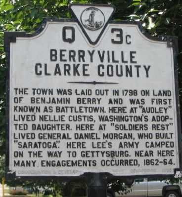
Berryville
Clarke County
Erected 1930 by Conservation & Development Commission. (Marker Number Q 3c.)
Topics and series. This historical marker is listed in these topic lists: Settlements & Settlers • War, US Civil • Women. In addition, it is included in the Former U.S. Presidents: #01 George Washington, and the Virginia Department of Historic Resources (DHR) series lists. A significant historical year for this entry is 1798.
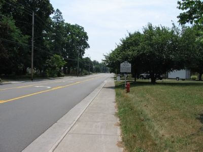
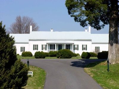
Location. 39° 9.341′ N, 77° 59.266′ W. Marker is in Berryville, Virginia, in Clarke County. Marker is on West Main Street (Business Virginia Route 7), on the right when traveling east. On the grounds of the Berryville Primary School. Touch for map. Marker is at or near this postal address: 317 West Main Street, Berryville VA 22611, United States of America. Touch for directions.
Other nearby markers. At least 9 other markers are within walking distance of this marker. James Ireland (approx. 0.3 miles away); Harry F. Byrd Sr. (approx. 0.3 miles away); Bank of Clarke County (approx. half a mile away); Clarke County Civil War Monument (approx. half a mile away); Clarke County Courthouse (approx. half a mile away); Traveler Was Tethered on This Spot (approx. half a mile away); Benjamin Berry (approx. half a mile away); King Wheat, Millwood & The Burwell-Morgan Mill (approx. half a mile away); Clarke County (approx. half a mile away). Touch for a list and map of all markers in Berryville.
Photographed By Craig Swain, July 15, 2007
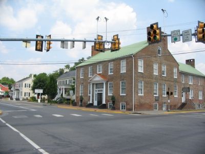
6. Hawthorne Building
Among the many historic structures in Berryville is the Hawthorne Building, standing at the intersection of Main Street (Route 7 Business) and Buckmarsh (U.S. 340). Built between 1815 and 1820, it served as a residence, library, doctor's office over the years.
Credits. This page was last revised on December 24, 2019. It was originally submitted on July 20, 2007, by Craig Swain of Leesburg, Virginia. This page has been viewed 2,246 times since then and 76 times this year. Photos: 1, 2. submitted on July 20, 2007, by Craig Swain of Leesburg, Virginia. 3. submitted on July 24, 2007, by Craig Swain of Leesburg, Virginia. 4. submitted on October 2, 2007, by Kevin W. of Stafford, Virginia. 5. submitted on July 24, 2007, by Craig Swain of Leesburg, Virginia. 6. submitted on July 20, 2007, by Craig Swain of Leesburg, Virginia. • J. J. Prats was the editor who published this page.
