Concord in Middlesex County, Massachusetts — The American Northeast (New England)
Meriamís Corner
Minute Man Nat'l Hist Park, Mass
ó National Park Service ó
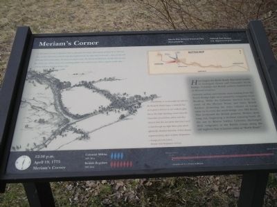
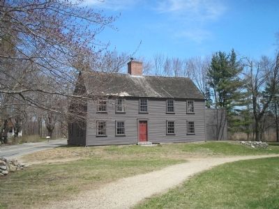
Colonial militia and minute men coming from the North Bridge fight were joined by companies from Reading. While the Colonists watched from the cover of the Meriam house and barn, British flankers protecting the main column of troops came in to cross the small bridge over Mill Brook. This weakened the British position. Musket shots rang out, beginning a six-hour running battle all the way to Boston harbor. Colonists discharged their vengeance at the British troops along the old highway that is known today as “Battle Road.”
“A little before we came to Meriamís hill, we discovered the enemyís flank guard, of about 80 or 100 men, who, on their retreat from Concord, kept that height of land, the main body in the road . . . About twenty rods [330 feet] short of that place, the Americans made a halt. The British marched down the hill with very slow, but steady step, without music or a word being spoken that could be heard. Silence reigned on both sides . . .”
- Edmund Foster, Reading Minute Man
“ . . . immediately as we descended the hill into the Road the Rebels begun a brisk fire but at so great a distance it was without effect, but as they kept marching nearer when the Grenadiers found them within shot they returned their fire just about that time I recíd a shot through my right elbow joint which effectually disabled that arm, it then became a general firing upon us from all quarters . . . ”
- Ensign Jeremy Lister, British 10th Regiment of Foot
12:30 p.m. April 19, 1775 Meriamís Corner
Colonial Militia 400 Men
British Regulars 700 Men
16 miles & 6 ½ hours to Boston.
Erected by Minute Man National Historical Park.
Topics. This historical marker is listed in these topic lists: Notable Events • War, US Revolutionary. A significant historical month for this entry is April 1863.
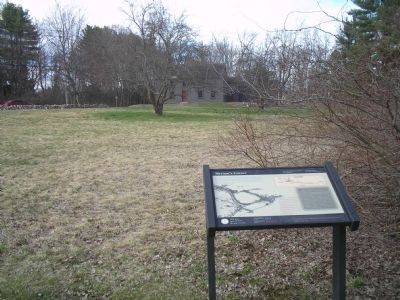
Location. 42° 27.562′ N, 71° 19.434′ W. Marker is in Concord, Massachusetts, in Middlesex County. Marker is at the intersection of Lexington Road and Old Bedford Road, on the right when traveling west on Lexington Road. Marker is in Minute Man National Historical Park, along Battle Road. Touch for map. Marker is in this post office area: Concord MA 01742, United States of America. Touch for directions.
Other nearby markers. At least 8 other markers are within walking distance of this marker. A different marker also named Meriamís Corner (within shouting distance of this marker); a different marker also named Meriamís Corner (about 600 feet away, measured in a direct line); Bedford Minutemen (about 700 feet
away); Ephraim Wales Bull (approx. 0.4 miles away); Nathaniel Hawthorne (approx. half a mile away); The Larch Path (approx. half a mile away); The First Settlement - 1635 (approx. half a mile away); Caseyís Home (approx. half a mile away). Touch for a list and map of all markers in Concord.
More about this marker. The left side of the marker contains a picture of the Colonials and the British troops clashing at Meriamís Corner. The top of the marker features a map of the route from Concord to Boston, with the site of the Meriamís Corner clash indicated.
Also see . . .
1. Minute Man National Historical Park. National Park Service website. (Submitted on April 18, 2009, by Bill Coughlin of Woodland Park, New Jersey.)
2. The Battle of Concord. The American Revolutionary War website. (Submitted on May 7, 2009, by Bill Coughlin of Woodland Park, New Jersey.)
Credits. This page was last revised on June 16, 2016. It was originally submitted on April 18, 2009, by Bill Coughlin of Woodland Park, New Jersey. This page has been viewed 3,554 times since then and 54 times this year. Photos: 1, 2, 3, 4, 5. submitted on April 18, 2009, by Bill Coughlin of Woodland Park, New Jersey.


