Near Courtland in Sussex County, Virginia — The American South (Mid-Atlantic)
Southampton County / Sussex County
Southampton County. Southampton County was formed in 1749 from Isle of Wight County, a part of Nansemond County was added later. The county was either named for the English borough of Southampton or for Henry Wriothesley, third earl of Southampton. In Aug. 1831, a slave rebellion took place here led by preacher and slave Nat Turner. Confederate General and Virginia U.S. senator William Mahone (1826-1895) lived a portion of his life here. The county seat is Courtland, formerly called Jerusalem.
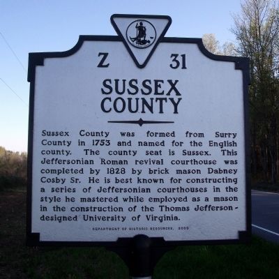
Sussex County. Sussex County was formed from Surry County in 1753 and named for the English county. The county seat is Sussex. This Jeffersonian Roman revival courthouse was completed by 1828 by brick mason Dabney Cosby Sr. He is best known for constructing a series of Jeffersonian courthouses in the style he mastered while employed as a mason in the construction of the Thomas Jefferson-designed University of Virginia.
Erected 2003 by Department of Historic Resources. (Marker Number Z-31.)
Topics and series. This historical marker is listed in this topic list: Political Subdivisions. In addition, it is included in the Former U.S. Presidents: #03 Thomas Jefferson, and the Virginia Department of Historic Resources (DHR) series lists. A significant historical month for this entry is August 1831.
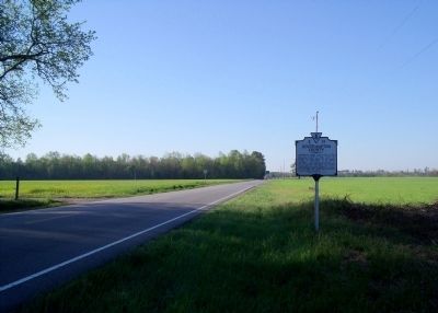
Location. 36° 51.139′ N, 77° 8.058′ W. Marker is near Courtland, Virginia, in Sussex County. Marker is on Plank Road (Virginia Route 35) half a mile north of Big Woods Road, on the right when traveling south. Touch for map. Marker is at or near this postal address: 12337 Plank Rd, Courtland VA 23837, United States of America. Touch for directions.
Other nearby markers. At least 8 other markers are within 10 miles of this marker, measured as the crow flies. Benjamin F. Hicks (approx. 6.6 miles away); Antioch Baptist Church (approx. 8.6 miles away); Sussex County War Memorial (approx. 9.2 miles away); Sussex County Courthouse (approx. 9.2 miles away); Sussex County Confederate Monument (approx. 9.2 miles away); Helping Hand Cemetery (approx. 9˝ miles away); Courtland School — Rosenwald Funded (approx. 9.8 miles away); Dred Scott And The Blow Family (approx. 10 miles away). Touch for a list and map of all markers in Courtland.
Also see . . .
1. Southampton County, Virginia. (Submitted on March 30, 2010.)
2. Sussex County, Virginia. (Submitted on March 30, 2010.)
Credits. This page was last revised on November 14, 2021. It was originally submitted on April 20, 2009, by Bernard Fisher of Richmond, Virginia. This page has been viewed 1,018 times since then and 26 times this year. Photos: 1, 2, 3. submitted on April 20, 2009, by Bernard Fisher of Richmond, Virginia.


