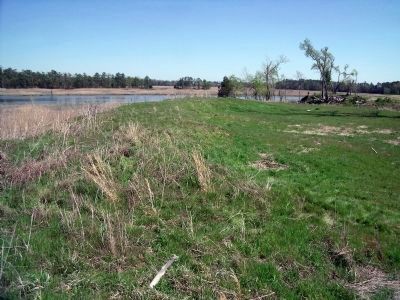
Suffolk, Virginia — The American South (Mid-Atlantic)
Siege of Suffolk
Bacon for the Confederacy
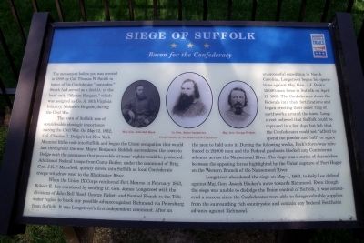
The town of Suffolk was of considerable strategic importance during the Civil War. On May 12, 1862, Col. Charles C. Dodge’s 1st New York Mounted Rifles rode into Suffolk and began the Union occupation that would last throughout the war. Mayor Benjamin Riddick surrendered the town to Dodge with the assurance that peaceable citizens’ rights would be protected. Additional Federal troops from Camp Butler, under the command of Brig. Gen. J.K.F. Mansfield, quickly moved into Suffolk as local Confederate troops withdrew west to the Blackwater River.
When the Union IX Corps reinforced Fort Monroe in February 1863, Robert E. Lee countered by sending Lt. Gen. James Longstreet with the divisions of John Bell Hood, George Pickett and Samuel French to the Tidewater region to block any possible advance against Richmond via Petersburg from Suffolk. It was Longstreet’s first independent command. After an unsuccessful expedition in North Carolina, Longstreet began his operations against Maj. Gen. J.J. Peck’s 15,000-man force in Suffolk on April 11, 1863. The Confederates drove the Federals into their fortifications and began erecting their outer ring of earthworks around the town. Longstreet believed that Suffolk could be captured in a few days but felt that the Confederates could not “afford to spend the powder and ball” or spare the men to hold onto it. During the following weeks, Peck’s force was reinforced to 29,000 men and the Federal gunboats blocked any Confederate advance across the Nansemond River. The siege was a series of skirmishes between the opposing forces highlighted by the Union capture of Fort Huger on the Western Branch of the Nansemond River.
Longstreet abandoned the siege on May 4, 1863, to help Lee defend against Maj. Gen. Joseph Hooker’s move towards Richmond. Even though the siege was unable to dislodge the Union control of Suffolk, it was considered a success since the Confederates were able to forage valuable supplies from the surrounding rich countryside and contain any Federal Southside advance against Richmond.
Erected by Virginia Civil War Trails.
Topics and series. This historical marker is listed in this topic list: War, US Civil. In addition, it is included in the Virginia Civil War Trails series list. A significant historical month for this entry is February 1863.
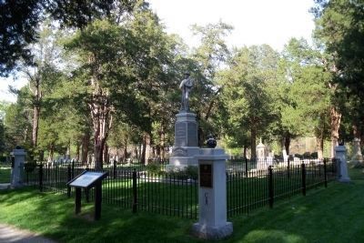
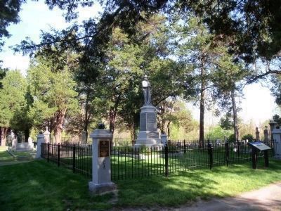
Location. 36° 44.098′ N, 76° 34.745′ W. Marker is in Suffolk, Virginia. Marker can be reached from Mahan Street, 0.2 miles east of North Main Street. The CWT marker is located in Cedar Hill Cemetery. Touch for map. Marker is at or near this postal address: 105 Mahan Street, Suffolk VA 23434, United States of America. Touch for directions.
Other nearby markers. At least 8 other markers are within walking distance of this marker. Confederate Monument (here, next to this marker); Remembrance Garden Monuments (within shouting distance of this marker); Watering Fountain (within shouting distance of this marker); Civil War Militia of Suffolk and Nansemond County (about 300 feet away, measured in a direct line); Spanish War Veterans Memorial (about 500 feet away); World War I Monument (about 600 feet away); World War II Memorial (about 800 feet away); Korea and Vietnam Wars Memorial (about 800 feet away). Touch for a list and map of all markers in Suffolk.
More about this marker. In the center are photographs of three Confederate Generals: “Maj. Gen. John Bell Hood”, “Lt. Gen. James Longstreet”, and “Maj. Gen. George Pickett”. Photos courtesy of The Museum of the Confederacy.
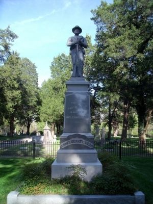
April 18, 2009
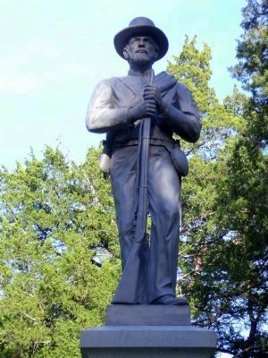
4. Confederate Dead
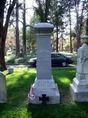
(front) Erected by Thos W. Smith in memory of his comrades.
(side) This shaft on which we carve no name, shall guide Virginia's youth - a sign-post on the road to fame, to honor and to truth.
A silent sentry, it shall stand to guard thro' coming time their graves who died for native land and duty most sublime.
(side) With shouts above the battle's roar they join the legions gone before; they bravely fought, they bravely fell, they wore the Gray and wore it well.
(rear) 1861-1889.
Credits. This page was last revised on February 1, 2023. It was originally submitted on April 20, 2009, by Bernard Fisher of Richmond, Virginia. This page has been viewed 3,383 times since then and 109 times this year. Photos: 1, 2. submitted on April 20, 2009. 3, 4, 5, 6, 7. submitted on April 22, 2009. 8. submitted on April 20, 2009. 9, 10, 11, 12, 13. submitted on April 21, 2009.
