Franklin, Virginia — The American South (Mid-Atlantic)
The Blackwater Line
“That little stream has … saved us”
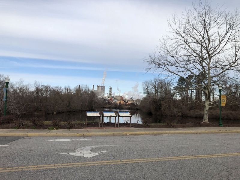
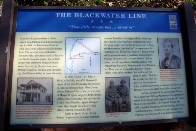
To protect Richmond from a Union attack from Suffolk, Confederate authorities fortified the Blackwater River in 1862. You are standing on the Blackwater Line. The intermittent earthworks stretched fifty miles from north of Zuni to the North Carolina border. Up to 9,000 troops were stationed along the Blackwater Line during the next two years. Despite occasional shelling and skirmishing, the Federals failed to cross the river.
In 1863, Union Gen. John J. Peck, in Suffolk, sent Col. Samuel P. Spear of the 11th Pennsylvania Cavalry to test the defenses here. Near Carrsville at Hebron Church on the morning of March 17, Spear engaged Confederate pickets who fled to the new earthworks a mile from Franklin. Spear charged twice, then fought an artillery duel before retiring toward Suffolk.
Early in April, three of Gen. James Longstreet’s divisions marched through Franklin to besiege Suffolk, while supplies flowed west from here to Richmond. Once the siege ended and the Confederates left in May, the Blackwater Line declined in importance. In 1864, however, Union Gen. August V. Kautz diverted his planned cavalry raid from Southampton County because, from the poor results “of two years past of expeditions directed against [the Petersburg Railroad], [he] reasoned that Blackwater River was an impassable barrier.” Elliott Story, a Franklin resident, had written of the river in 1863, “That little stream has thus far saved us thousands of dollars worth of property as well as the alarm and distress that would other wise fallen to our lot.”
As Gen. Ulysses S. Grant besieged Petersburg, some local African Americans liberated themselves from slavery and slipped through the Union lines to join the 38th U.S. Colored Troops. By 1865, constant foraging and skirmishing had wearied Southampton County citizens, ravaged the economy, and devastated once-prosperous farms.
Erected by Virginia Civil War Trails.
Topics and series. This historical marker is listed in these topic lists: African Americans • War, US Civil. In addition, it is included in the Virginia Civil War Trails series list. A significant historical date for this entry is March 17, 1863.
Location. 36° 40.46′ N, 76° 55.164′ W. Marker is in Franklin, Virginia. Marker is at the intersection of South Main Street and South Street, on the left when traveling south on South Main Street. Touch for map. Marker is in this post office area: Franklin VA 23851, United States of America. Touch for directions.
Other nearby markers. At least 8 other markers are within walking distance of this marker. Battle of Franklin (here, next to this marker); Confederate Commissary Center (here, next to this marker); The Barretts: A Franklin Pioneer Family (a few steps from this marker); The Age of Steam (a few steps from this marker); War Comes to the Blackwater (a few steps from this marker); "Can't Is Not in the Camp's Vocabulary" (a few steps from this marker); The Age of Gasoline (a few steps from this marker); Recovery and Progress (a few steps from this marker). Touch for a list and map of all markers in Franklin.
More about this marker. On the lower left is a photo captioned, “By the end of the Civil War, Franklin consisted of a few houses from South Street to the railroad, the depot, the hotel, and several stores on Main Street. The Gardner and Lee store was photographed about 1881.” – Courtesy Daniel T. Balfour, Southampton County and Franklin: A Pictorial History
On the upper center is a regional map of the Blackwater River Line.
On the upper right is a photo with the caption, “Elliot Story, a local resident, kept a diary during the war and described events in Franklin and Southampton Co.” – Courtesy Daniel T. Balfour, Southampton County and Franklin: A Pictorial History
On the lower

Photographed By Devry Becker Jones (CC0), January 30, 2021
3. Virginia Civil War Trails markers on display
Also see . . . Blackwater Line--Franklin. Stopping Points website entry (Submitted on July 17, 2022, by Larry Gertner of New York, New York.)
Additional keywords. USCT
Credits. This page was last revised on July 17, 2022. It was originally submitted on April 20, 2009, by Bernard Fisher of Richmond, Virginia. This page has been viewed 2,353 times since then and 101 times this year. Photos: 1, 2. submitted on April 20, 2009, by Bernard Fisher of Richmond, Virginia. 3. submitted on January 31, 2021, by Devry Becker Jones of Washington, District of Columbia.

