Port Clinton in Ottawa County, Ohio — The American Midwest (Great Lakes)
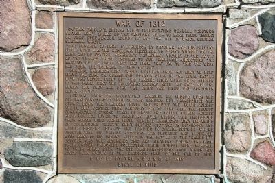
War of 1812
"The defense of Fort Stephenson by Croghan and his gallant little band was the necessary precursor to Perry's victory on the lake and of General Harrison's triumphant victory at the Battle of the Thames. These assured to our immediate ancestors the mastery of the Great West and from that day to this the west has been the bulwark of this nation."
General Harrison sent expert riflemen from his army to help serve the guns on Commodore Perry's ships in the naval battle with the British Fleet off this landing from which on September 10, 1813 Perry sent the following laconic note, "we have met the enemy and they are ours, two ships, two brigs, one schooner,and a sloop."
General Harrison immediately marched his troops over the Old Sandusky-Scioto Trail to this landing, but transported the stores down the Sandusky River and dragged the boats across the De Lery Portage. From Sandusky Bay to Lake Erie the troops constructed a strong fence of brush and fallen timber across from Portage River to Sandusky River. Within this enclosure their horses were turned loose. General Harrison's army embarked on Commodore Perry's ships Sept. 20, stopping on Put-In-Bay and Middle Sisters Islands and landing in Canada Sept.27 where Proctor with his British regulars was defeated and Tecumseh with many of his British regulars was defeated and Tecumseh with many of his Indians killed in the Battle of the Thames, 5th October, 1813. The returning Ohio and Kentucky volunteers, with their British prisoners, collecting their horses here, marched to their homes over the old Sandusky-Scioto Trail, which has since been known as the Harrison Trail of the War of 1812.
Erected by the National Society, United States Daughters (N.S.U.S.D.) of 1812, State of Ohio.
Topics. This historical marker is listed in this topic list: War of 1812. A significant historical month for this entry is September 1864.
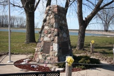
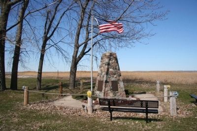
Location. 41° 30.828′ N, 82° 56.018′ W. Marker is in Port Clinton, Ohio, in Ottawa County. Marker is at the intersection of East Perry Street (State Road 163) and Fulton Street, on the right when traveling east on East Perry Street. This historical marker is located at the northern end of the De Lery Portage. The De Lery Portage ran north and south, from the southern shore of Lake Erie, to the northern shore of Sandusky Bay, along the length of modern day Fulton St., in Port Clinton, Ohio. Touch for map. Marker is in this post office area: Port Clinton OH 43452, United States of America. Touch for directions.
Other nearby markers. At least 8 other markers are within walking distance of this marker. American Expedition 1813 (here, next to this marker); Keeper's Boathouse (about 500 feet away, measured in a direct line); Port Clinton Light Station (about 500 feet away); "Lightkeepers" (about 500 feet away); This Millstone (approx. 0.2 miles away); Battle Of Lake Erie Gun (approx. ¼ mile away); Indian Mill Stone (approx. ¼ mile away); This Anchor (approx. ¼ mile away). Touch for a list and map of all markers in Port Clinton.
More about this marker. This historical marker, like the northern end of the De Lery Portage, is located at the eastern edge of the mouth of the Portage River. It was the mouth of the Portage River that had served as a landmark, telling those travelers venturing along the shores of Lake Erie, seeking the De Lery Portage as a short cut to the Sandusky River, exactly where the portage was located.
Credits. This page was last revised on January 29, 2021. It was originally submitted on April 24, 2009, by Dale K. Benington of Toledo, Ohio. This page has been viewed 1,596 times since then and 44 times this year. Last updated on January 28, 2021, by Craig Doda of Napoleon, Ohio. Photos: 1, 2, 3. submitted on April 24, 2009, by Dale K. Benington of Toledo, Ohio. • Bill Pfingsten was the editor who published this page.


