Mount Rose in Mercer County, New Jersey — The American Northeast (Mid-Atlantic)
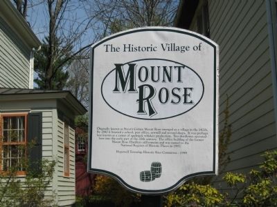
The Historic Village of Mount Rose
Erected 1999 by Hopewell Township Historic Sites Committee.
Topics. This historical marker is listed in this topic list: Settlements & Settlers. A significant historical year for this entry is 1880.
Location. 40° 22.172′ N, 74° 44.335′ W. Marker is in Mount Rose, New Jersey, in Mercer County. Marker is at the intersection of Cherry Valley Road and Hopewell Princeton Road, on the right when traveling west on Cherry Valley Road. Touch for map. Marker is in this post office area: Hopewell NJ 08525, United States of America. Touch for directions.
Other nearby markers. At least 8 other markers are within 4 miles of this marker, measured as the crow flies. Hopewell Call To Duty (approx. 1.6 miles away); Hopewell Academy (approx. 1.8 miles away); Joab Houghton (approx. 1.9 miles away); Province Line Road (approx. 2 miles away); John Hart (approx. 2.2 miles away); Delaware and Bound Brook Railroad Historic District (approx. 2.4 miles away); Blawenburg (approx. 3½ miles away); Washington’s Spring (approx. 3.9 miles away).
Credits. This page was last revised on June 16, 2016. It was originally submitted on April 25, 2009, by Alan Edelson of Union Twsp., New Jersey. This page has been viewed 1,585 times since then and 29 times this year. Photo 1. submitted on April 25, 2009, by Alan Edelson of Union Twsp., New Jersey. • Bill Pfingsten was the editor who published this page.
