Near Manassas in Prince William County, Virginia — The American South (Mid-Atlantic)
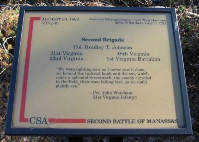
Second Brigade
Second Battle of Manassas
3:15 p.m.
Jackson's Division (Starke), Left Wing (Jackson)
Army of Northern Virginia, CSA
Second Brigade
Col. Bradley T. Johnson
21st Virginia 48th Virginia
42nd Virginia 1st Virginia Battalion
"We were fighting now as I never saw it done, we behind the railroad bank and the cut, which made a splendid breastwork, the enemy crowded in the field, their men falling fast, as we could plainly see."
- Pvt. John Worsham
21st Virginia Infantry
Topics. This historical marker is listed in this topic list: War, US Civil. A significant historical year for this entry is 1862.
Location. 38° 49.226′ N, 77° 33.321′ W. Marker is near Manassas, Virginia, in Prince William County. Marker can be reached from Fetherbed Lane (County Route 622), on the right when traveling south. Located on the Deep Cut Trail, along the old railroad bed, in Manassas National Military Park. Touch for map. Marker is in this post office area: Manassas VA 20109, United States of America. Touch for directions.
Other nearby markers. At least 8 other markers are within walking distance of this marker. 13th New York Infantry (about 400 feet away, measured in a direct line); Groveton Monument (about 400 feet away); Groveton Memorial (about 400 feet away); 83rd Pennsylvania Infantry (about 500 feet away); The Rock Fight (about 600 feet away); a different marker also named The Rock Fight (about 600 feet away); 24th New York Infantry (about 700 feet away); Fourth Brigade (about 700 feet away). Touch for a list and map of all markers in Manassas.

Photographed By Craig Swain, February 8, 2009
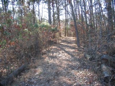
4. Second Brigade Position
Looking back at the marker location from a point further east on the trail (which follows the railroad bed). Johnson's Brigade held a line along the railroad bed, near a stand of trees, facing south (left in this view). The railroad enters a cut just to the right of this view.
Credits. This page was last revised on June 16, 2016. It was originally submitted on April 26, 2009, by Craig Swain of Leesburg, Virginia. This page has been viewed 979 times since then and 14 times this year. Photos: 1, 2, 3, 4. submitted on April 26, 2009, by Craig Swain of Leesburg, Virginia.


