Near Manassas in Prince William County, Virginia — The American South (Mid-Atlantic)
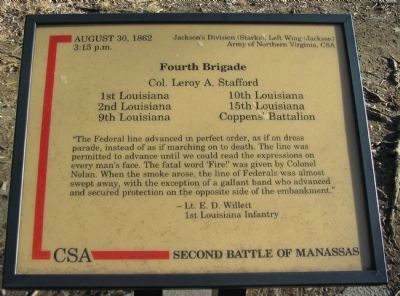
Fourth Brigade
Second Battle of Manassas
3:15 p.m.
Jackson's Division (Starke), Left Wing (Jackson)
Army of Northern Virgina, CSA
Fourth Brigade
Col. Leroy A. Stafford
1st Louisiana 10th Louisiana
2nd Louisiana 15th Louisiana
9th Louisiana Coppens' Battalion
"The Federal line advanced in perfect order, as if on dress parade, instead of as if marching on to death. The line was permitted to advance until we could read the expressions on every man's face. The fatal word "Fire!" was given by Colonel Nolan. When the smoke arose, the line of Federals was almost swept away, with the exception of a gallant band who advanced and secured protection on the opposite side of the embankment."
- Lt. E.D. Willett
1st Louisiana Infantry
Topics. This historical marker is listed in this topic list: War, US Civil. A significant historical year for this entry is 1862.
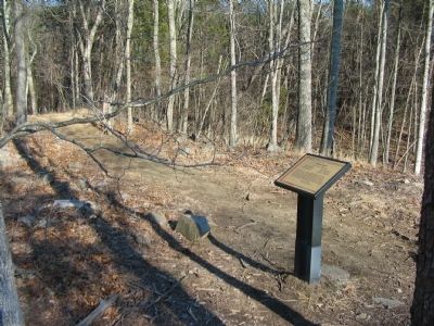
Location. 38° 49.295′ N, 77° 33.198′ W. Marker is near Manassas, Virginia, in Prince William County. Marker can be reached from Fetherbed Lane (County Route 622), on the right when traveling south. Located on the Deep Cut Trail, along the old railroad bed, in Manassas National Military Park. Touch for map. Marker is in this post office area: Manassas VA 20109, United States of America. Touch for directions.
Other nearby markers. At least 8 other markers are within walking distance of this marker. 24th New York Infantry (a few steps from this marker); The Rock Fight (within shouting distance of this marker); a different marker also named The Rock Fight (within shouting distance of this marker); 83rd Pennsylvania Infantry (about 300 feet away, measured in a direct line); Groveton Monument (about 300 feet away); Groveton Memorial (about 300 feet away); 13th New York Infantry (about 300 feet away); 15th Alabama Infantry (about 400 feet away). Touch for a list and map of all markers in Manassas.
Credits. This page was last revised on June 16, 2016. It was originally submitted on April 27, 2009, by Craig Swain of Leesburg, Virginia. This page has been viewed 1,064 times since then and 8 times this year. Photos: 1, 2, 3. submitted on April 27, 2009, by Craig Swain of Leesburg, Virginia.


