Lexington in Middlesex County, Massachusetts — The American Northeast (New England)
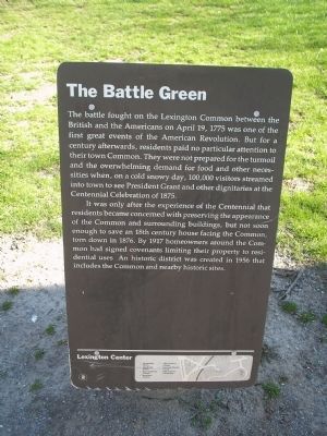
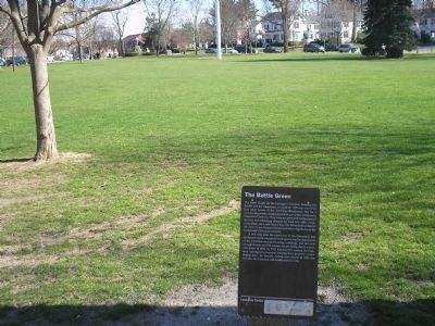
The Battle Green
The battle fought on the Lexington Common between the British and the Americans on April 19, 1775 was one of the first great events of the American Revolution. But for a century afterwards, residents paid no particular attention to their town Common. They were not prepared for the turmoil and the over whelming demand for food and other necessities when, on a cold snowy day, 100,000 visitors streamed into town to see President Grant and other dignitaries at the Centennial Celebration of 1875.
It was only after the experience of the Centennial that residents became concerned with preserving the appearance of the Common and surrounding buildings, but not soon enough to save an 18th century house facing the Common, torn down in 1876. By 1917 homeowners around the Common had signed covenants limiting their property to residential uses. An historic district was created in 1956 that includes the Common and nearby historic sites.
Topics and series. This historical marker is listed in these topic lists: Colonial Era • Notable Places • War, US Revolutionary. In addition, it is included in the Former U.S. Presidents: #18 Ulysses S. Grant series list. A significant historical month for this entry is April 1844.
Location. 42° 26.999′ N, 71° 13.846′ W. Marker is in Lexington, Massachusetts , in Middlesex County. Marker is on Harrington Road, on the right when traveling east. Touch for map. Marker is in this post office area: Lexington MA 02420, United States of America. Touch for directions.
Other nearby markers. At least 8 other markers are within walking distance of this marker. House of Jonathan Harrington (a few steps from this marker); Cambridge Farms (within shouting distance of this marker); First Teachers' College (within shouting distance of this marker); Buckman Tavern (within shouting distance of this marker); Battle of Lexington Monument (within shouting distance of this marker); Lexington Green (within shouting distance of this marker); This Flag Pole (within shouting distance of this marker); Memorial to the Lexington Minute Men (about 300 feet away, measured in a direct line). Touch for a list and map of all markers in Lexington.
More about this marker. The bottom of the marker contains a map of Lexington Center with the location of the Battle Green indicated.
Also see . . .
1. Battle of Lexington. (Submitted on April 30, 2009, by Bill Coughlin of Woodland Park, New Jersey.)
2. Battle at Lexington Green, 1775. The Start of the American Revolution and the "shot heard round the world." from EyeWitness to History.com. (Submitted on April 30, 2009, by Bill Coughlin of Woodland Park, New Jersey.)
Credits. This page was last revised on August 2, 2020. It was originally submitted on April 30, 2009, by Bill Coughlin of Woodland Park, New Jersey. This page has been viewed 1,449 times since then and 29 times this year. Photos: 1, 2. submitted on April 30, 2009, by Bill Coughlin of Woodland Park, New Jersey.

