San Martin in Santa Clara County, California — The American West (Pacific Coastal)
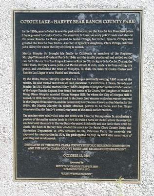
Coyote Lake – Harvey Bear Ranch County Park
Martin Murphy Sr. brought his family to California as members of the Stephens- Murphy-Townsend Overland Party in 1844, and the family purchased and settled on the rancho to the north of Las Llagas, known as Rancho Ojo de Agua de la Coche. During the Gold Rush, Murphy's sons, John and Daniel, struck it rich, made a fortune selling dry goods, and established the town of Murphys. In 1848, the heirs of Carlos Castro sold Rancho Las Llagas to sons Daniel and Bernard.
By the 1850s, Daniel Murphy operated Las Llagas eventually owning 7,800 acres of the rancho. He also owned vast tracts of land elsewhere in California, Arizona, Nevada and Mexico. In 1851, Daniel married Mary Fisher; daughter of neighbor William Fisher, owner of the larger Rancho Laguna Seca found just north of La Coche. The daughter of Daniel & Mary, Diana Murphy, married Hiram Morgan Hill, for whom the City of Morgan Hill is named. In 1853, brother Bernard died in the Jenny Lind steamer explosion; was re-interred in the Chapel of San Martin, and the community later became known as San Martin. In the 1860s, the Martin Murphy Sr. family obtained patents to La Polka and Las Llagas demonstrating the family's control over most of the area's earlier ranchos.
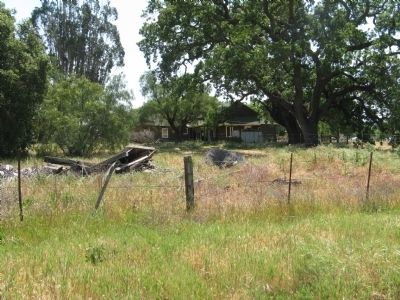
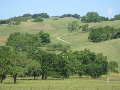
The ranchos were subdivided after the 1890s with John Jay Baumgartner Jr. purchasing a portion of the earlier rancho lands in 1949. He built a home on the hill above the reservoir and later sold the ranch to Harvey Bear who raised his family and ran cattle there until his death. The heirs of Harvey Bear deeded the ranch to the Santa Clara County Parks and Recreation Department in 1997. Situated on the Calaveras Fault, the reservoir was approved for construction in 1934. The park opened on May 14, 2005 after many years of planning and development.
and the Santa Clara County Parks and Recreation Department
October 13, 2007
Sponsored by
Mountain Charlie Chapter No. 1850
E Clampus Vitus Inc.
"Right Wrongs Nobody"
Erected 2007 by Santa Clara County Historic Heritage Commission, the Santa Clara County Parks and Recreation Department and Mountain Charlie Chapter No.1850, E Vitus Clampus.
Topics and series. This historical marker is listed in these topic lists: Industry & Commerce • Settlements & Settlers. In addition, it is included in the E Clampus Vitus series list. A significant historical month for this entry is May 1636.
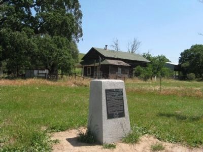
Location. 37° 5.968′ N, 121° 34.524′ W. Marker is in San Martin, California, in Santa Clara County. Marker can be reached from East San Martin Avenue west of New Avenue, on the left when traveling east. Marker is located at the Trailhead at the Coyote Lake-Harvey Bear Ranch County Park. Touch for map. Marker is at or near this postal address: 2080 East San Martin Avenue, San Martin CA 95046, United States of America. Touch for directions.
Other nearby markers. At least 8 other markers are within 5 miles of this marker, measured as the crow flies. Pioneering Murphy Family (here, next to this marker); Community of San Martin (approx. 2.2 miles away); Rucker School Historical Site 1894 (approx. 3.2 miles away); Franklin Family Ranch (approx. 3.4 miles away); Site of 21-Mile House (approx. 3.8 miles away); de Anza Expedition (approx. 4 miles away); John Page House (approx. 4.6 miles away); Waiting For The Train (approx. 4.6 miles away). Touch for a list and map of all markers in San Martin.
Regarding Coyote Lake – Harvey Bear Ranch County Park. Also see: “Community of San Martin” and “Pioneering Murphy Family” nearby markers for additional information regarding the Murphy family.
Also see . . . Coyote Lake (Santa Clara County, California). Wikipedia entry. (Submitted on September 22, 2020, by Larry Gertner of New York, New York.)
Credits. This page was last revised on August 13, 2023. It was originally submitted on May 2, 2009, by Syd Whittle of Mesa, Arizona. This page has been viewed 2,156 times since then and 42 times this year. Photos: 1, 2, 3, 4. submitted on May 2, 2009, by Syd Whittle of Mesa, Arizona.
Editor’s want-list for this marker. Photo of Reservoir • Can you help?


