Marker Logo HMdb.org THE HISTORICAL
MARKER DATABASE
“Bite-Size Bits of Local, National, and Global History”
High Shoals in Gaston County, North Carolina — The American South (South Atlantic)
 

John Fulenwider


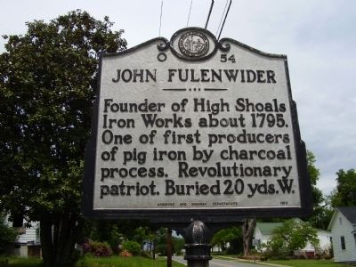
John Fulenwider Marker image. Click for full size.
Photographed By Stanley and Terrie Howard, May 2, 2009
1. John Fulenwider Marker
Inscription. Founder of High Shoals Iron Works about 1795. One of first producers of pig iron by charcoal process. Revolutionary patriot. Buried 20 yds. W.
 
Erected 1960 by Archives and Highway Departments. (Marker Number O-54.)
 
Topics and series. This historical marker is listed in these topic lists: Industry & CommercePatriots & PatriotismWar, US Revolutionary. In addition, it is included in the North Carolina Division of Archives and History series list. A significant historical year for this entry is 1795.
 
Location. 35° 24.098′ N, 81° 12.123′ W. Marker is in High Shoals, North Carolina, in Gaston County. Marker is on North Lincoln Street (State Highway 321) near Thompkins Street (State Highway 1812), on the right when traveling south. Touch for map. Marker is at or near this postal address: 114 North Lincoln Street, High Shoals NC 28077, United States of America. Touch for directions.
 
Other nearby markers. At least 8 other markers are within 6 miles of this marker, measured as the crow flies. Iron Works (approx. 3.9 miles away); Daniel E. Rhyne / Laboratory Historic District (approx. 4 miles away); Confederate Laboratory (approx. 5.1 miles away); Plonk Family Cemetery (approx. 5.4 miles away); Schenck-Warlick Mill (approx. 5˝ miles
Paid Advertisement
Click on the ad for more information.
Please report objectionable advertising to the Editor.
Click or scan to see
this page online
away); Cemetery (approx. 5˝ miles away); J.G. Arends (approx. 5.6 miles away); "Old White Church" Cemetery / " Old White Church " (approx. 5.6 miles away).
 
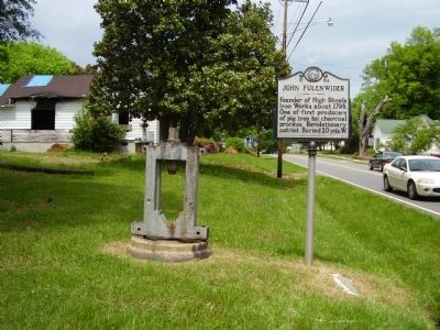
John Fulenwider Marker image. Click for full size.
Photographed By Stanley and Terrie Howard, May 2, 2009
2. John Fulenwider Marker
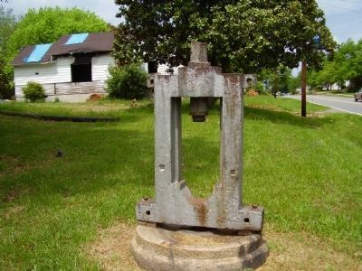
Machinery Item near the marker image. Click for full size.
Photographed By Stanley and Terrie Howard, May 2, 2009
3. Machinery Item near the marker
While there is no information to identify the purpose of this object, it can be assumed it was once part of Fulenwider's ironworks, which remained in operation until 1875.
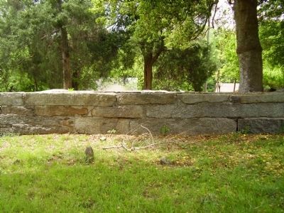
John Fulenwider Grave Site image. Click for full size.
Photographed By Stanley and Terrie Howard, May 2, 2009
4. John Fulenwider Grave Site
About 20 yds. west of the marker.
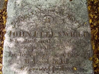
John Fulenwider Grave Marker image. Click for full size.
Photographed By Stanley and Terrie Howard, May 2, 2009
5. John Fulenwider Grave Marker
High Shoals United Methodist Church image. Click for full size.
Photographed By Stanley and Terrie Howard, May 2, 2009
6. High Shoals United Methodist Church
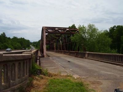
Old High Shoals Bridge image. Click for full size.
Photographed By Stanley and Terrie Howard, May 2, 2009
7. Old High Shoals Bridge
Now closed to traffic.
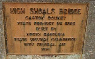
State Highway Commission Plaque at the High Shoals Bridge image. Click for full size.
Photographed By Stanley and Terrie Howard, May 2, 2009
8. State Highway Commission Plaque at the High Shoals Bridge
Gaston County
State Project No. 6302
Built by
North Carolina
State Highway Commission
With Federal Aid
1931
 
 
Credits. This page was last revised on March 17, 2024. It was originally submitted on May 3, 2009, by Stanley and Terrie Howard of Greer, South Carolina. This page has been viewed 915 times since then and 18 times this year. Photos:   1, 2, 3, 4, 5, 6, 7, 8. submitted on May 3, 2009, by Stanley and Terrie Howard of Greer, South Carolina. • Kevin W. was the editor who published this page.
Share this page.  
Share on Tumblr
m=18571

CeraNet Cloud Computing sponsors the Historical Marker Database.
This website earns income from purchases you make after using our links to Amazon.com. We appreciate your support.
Paid Advertisement
Apr. 25, 2024