Downtown in Boston in Suffolk County, Massachusetts — The American Northeast (New England)
The Old State House
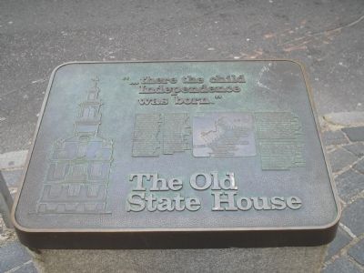
“ . . . there the child Independence was born.”
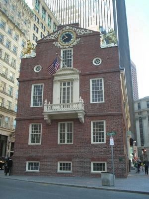
Built in 1713, the Old State House was the seat of government of the Province of Massachusetts Bay. In this building the Royal Governors, the Colonial Courts, and the Provincial Assembly met before the Revolution, and here the government of the Commonwealth of Massachusetts continued after independence. In the Council Chamber James Otis argued forcefully and eloquently against the Writs of Assistance in 1761. In Representatives Hall John Hancock and Samuel Adams denounced the right of taxation by Parliament. Though no longer extant, the world's first gallery from which the public could watch their government in action was build as the result of a motion by James Otis and Samuel Adams in 1766. On July 18, 1776 the Declaration of Independence was read for the first time to the citizens of Boston from the eastern balcony.
Erected by National Park Service.
Topics. This historical marker is listed in these topic lists: Colonial Era • Notable Buildings • War, US Revolutionary. A significant historical date for this entry is July 18, 1776.
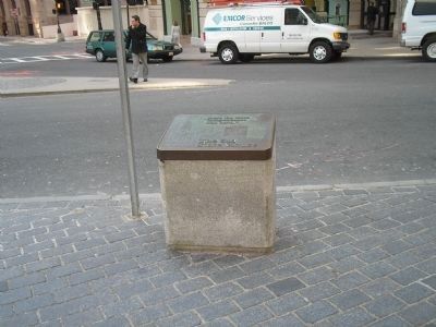
Location. 42° 21.526′ N, 71° 3.436′ W. Marker is in Boston, Massachusetts, in Suffolk County. It is in Downtown. Marker is at the intersection of Devonshire St. and State St., on the right when traveling south on Devonshire St.. Touch for map. Marker is in this post office area: Boston MA 02108, United States of America. Touch for directions.
Other nearby markers. At least 8 other markers are within walking distance of this marker. A different marker also named The Old State House (here, next to this marker); The Freedom Trail (a few steps from this marker); The Boston Massacre (a few steps from this marker); Site of the First Meeting House in Boston Built A.D. 1632 (a few steps from this marker); The Norman B. Leventhal Walk to the Sea (within shouting distance of this marker); Captain Robert Keayne (within shouting distance of this marker); Magoun Counting-House Site (within shouting distance of this marker); New England Courant (within shouting distance of this marker). Touch for a list and map of all markers in Boston.
More about this marker. The left side of the marker contains an image of the Old State House. The right side of the marker features a map of the Freedom Trail, with the caption “In recognition of the national significance of seven of Boston’s most important historic sites, Congress has created the Boston National Historic Park. These sites, now part of our National Park System, are the Old South Meeting House, the Old State House, Faneuil Hall, Paul Revere House, Old North Church, the Bunker Hill Monument and part of the Charlestown Navy Yard, including
the U.S.S. Constitution.
This historic site is recognized under a cooperative agreement with the Bostonian Society, the City of Boston, and the National Park Service, U.S. Department of the Interior. The Bostonian Society maintains and operates the museum, while the City of Boston owns the structure. The National Park Service funds major rehabilitation and provides some technical assistance.”
Also see . . . Old State House. Details of the Freedom Trail from the City of Boston website. (Submitted on May 6, 2009, by Bill Coughlin of Woodland Park, New Jersey.)
Credits. This page was last revised on January 30, 2023. It was originally submitted on May 6, 2009, by Bill Coughlin of Woodland Park, New Jersey. This page has been viewed 1,003 times since then and 24 times this year. Photos: 1, 2, 3. submitted on May 6, 2009, by Bill Coughlin of Woodland Park, New Jersey.


