Cumberland in Allegany County, Maryland — The American Northeast (Mid-Atlantic)
The Old National Pike
— Fort Cumberland Trail —
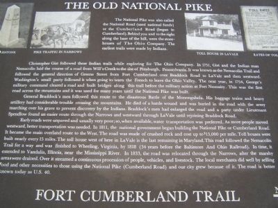
Christopher Gist followed these Indian trails while exploring for The Ohio Company. In 1751, Gist and the Indian man Nemacolin laid the course of a road from Will's Creek to the site of Pittsburgh, Pennsylvania. It was known as the Nemacolin Trail and followed the general direction of Greene Street from Fort Cumberland over Braddock Road to LaVale and then westward. Washington's small party followed it when going to warn the French to leave the Ohio Valley. The next year, in 1754, George's military command cleared a road and built bridges along this trail before the military action at Fort Necessity. This was the first road across the mountains and it was used for many years until the National Pike was built.
General Braddock's men followed this route to the disastrous Battle of the Monongahela. His baggage trains and heavy artillery had considerable trouble crossing the mountains. He died of a battle wound and was buried in the road with the army marching over his grave to prevent discovery by the Indians. Braddock's men had enlarged the road and a party under Lieutenant Spendlow found an easier route through the Narrows and westward through LaVale until rejoining Braddock Road.
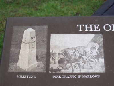
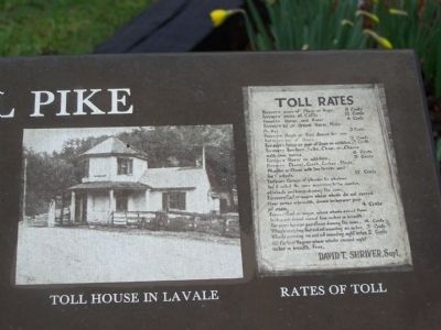
Early roads were unpaved and usually very poor; so, when available, water transportation was preferred. As more people moved westward, better transportation was needed. In 1811, the national government began building the National Pike or Cumberland Road. It became the main overland route to the West. the road was made of crushed rock and cost up to $13,000 per mile. Toll houses were built nearly every 15 miles. The toll house west of here in LaVale is the last remaining in Maryland. This road followed the Nemacolin Trail for a way and was finished to Wheeling, Virginia, by 1818 (34 years before the Baltimore and Ohio Railroad). In time, it extended to Vandalia, Illinois, near the Mississippi River. In 1833, the road was relocated through the Narrows, after the marshy areas were drained. Over it streamed a continuous procession of people, vehicles, and livestock. The local merchants did well by selling food and other necessities to those using the National Pike (Cumberland Road) and our city grew because of it. The road is better known today as U.S. 40.
Fort Cumberland Trail
Topics and series. This historical marker is listed in these topic lists: Native Americans • Notable Events
• Roads & Vehicles. In addition, it is included in the The Historic National Road series list. A significant historical year for this entry is 1751.
Location. 39° 38.982′ N, 78° 45.911′ W. Marker is in Cumberland, Maryland, in Allegany County. Marker is at the intersection of Greene St. and Bridge Street on Greene St.. Touch for map. Marker is in this post office area: Cumberland MD 21502, United States of America. Touch for directions.
Other nearby markers. At least 8 other markers are within walking distance of this marker. Beginning Of National Pike (here, next to this marker); Where the Road Began (within shouting distance of this marker); National Road Monument (within shouting distance of this marker); Riverside Park (within shouting distance of this marker); Fort Cumberland Trail (within shouting distance of this marker); Headquarters of George Washington (within shouting distance of this marker); George Washington at Will’s Creek (within shouting distance of this marker); Col. Joshua Fry (within shouting distance of this marker). Touch for a list and map of all markers in Cumberland.
Credits. This page was last revised on July 10, 2021. It was originally submitted on May 7, 2009, by Bill Pfingsten of Bel Air, Maryland. This page has been viewed 2,236 times since then and 70 times this year. Last updated on February 17, 2021, by Carl Gordon Moore Jr. of North East, Maryland. Photos: 1. submitted on May 7, 2009, by Bill Pfingsten of Bel Air, Maryland. 2. submitted on June 30, 2021, by Bradley Owen of Morgantown, West Virginia. 3, 4. submitted on May 7, 2009, by Bill Pfingsten of Bel Air, Maryland.


