Mount Vernon in Knox County, Ohio — The American Midwest (Great Lakes)
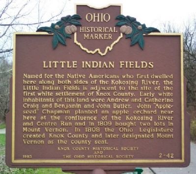
Little Indian Fields
Erected 1993 by Knox County Historical Society and The Ohio Historical Society. (Marker Number 2-42.)
Topics and series. This historical marker is listed in these topic lists: Native Americans • Settlements & Settlers • Waterways & Vessels. In addition, it is included in the Ohio Historical Society / The Ohio History Connection series list. A significant historical year for this entry is 1809.
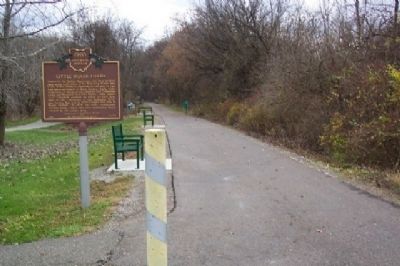
Location. 40° 22.959′ N, 82° 28.104′ W. Marker is in Mount Vernon, Ohio, in Knox County. Marker is at the intersection of Lower Gambier Road (County Route 262) and Mount Vernon Avenue, on the right when traveling south on Lower Gambier Road. Marker is next to the pavilion along the Kokosing Gap Trail. Touch for map. Marker is in this post office area: Mount Vernon OH 43050, United States of America. Touch for directions.
Other nearby markers. At least 8 other markers are within one mile of this marker, measured as the crow flies. Lakeholm Administration Building (approx. 0.8 miles away); Knox County Korean War Memorial (approx. one mile away); Johnny Appleseed's Early Landholdings (approx. 1.1 miles away); Congressional Medal Of Honor Recipients (approx. 1.1 miles away); Knox County Pays Tribute (approx. 1.1 miles away); Knox County Courthouse (approx. 1.1 miles away); War Savings Stamps (approx. 1.1 miles away); South Main Plaza (approx. 1.1 miles away). Touch for a list and map of all markers in Mount Vernon.
Credits. This page was last revised on December 2, 2019. It was originally submitted on May 8, 2009, by William Fischer, Jr. of Scranton, Pennsylvania. This page has been viewed 1,458 times since then and 30 times this year. Photos: 1, 2, 3. submitted on May 8, 2009, by William Fischer, Jr. of Scranton, Pennsylvania. • Syd Whittle was the editor who published this page.


