Harpers Ferry in Jefferson County, West Virginia — The American South (Appalachia)
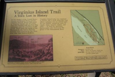
Virginius Island Trail
A Town Lost in History
Virginius Island today has returned to nature, but a stroll along this trail offers a glimpse into its colorful past. As you explore, search for ruins of canals, dams, tunnels, homes, and mills - all built by optimistic businessmen who harnessed the power of the Shenandoah River.
Time - About 45 minutes, round trip
Difficulty - An easy stroll over a level, partially graded path
Protection of these irreplaceable ruins is your responsibility. Please leave them undisturbed.
Topics. This historical marker is listed in this topic list: Industry & Commerce.
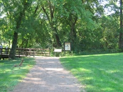
Location. Marker has been reported missing. It was located near 39° 19.295′ N, 77° 44.016′ W. Marker was in Harpers Ferry, West Virginia, in Jefferson County. Marker could be reached from Shenandoah Street (Business U.S. 340), on the right when traveling east. Located at the start of the trail over Virginius Island in Harpers Ferry National Historic Site. Touch for map. Marker was in this post office area: Harpers Ferry WV 25425, United States of America. Touch for directions.
Other nearby markers. At least 8 other markers are within walking distance of this location. Shenandoah Canal (within shouting distance of this marker); Cotton Mill (about 300 feet away, measured in a direct line); Water Tunnels (about 400 feet away); Jefferson Rock (about 500 feet away); a different marker also named Jefferson Rock (about 500 feet away); Butcher Shop and Boarding House (about 500 feet away); Revolutionary War Soldier (about 500 feet away); A Government Factory Town (about 600 feet away). Touch for a list and map of all markers in Harpers Ferry.
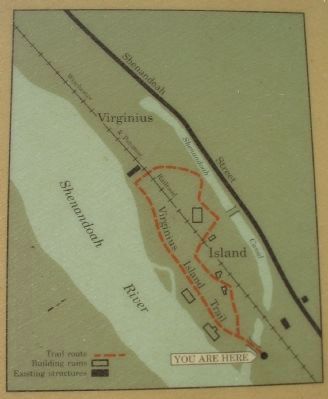
More about this marker. On the lower left is a Lithograph of Virginius Island,drawn near Jefferson Rock in 1857. Ruins of many of the buildings remain visible along the trail. On the lithograph, locations of the cotton mill, Shenandoah Canal, valley mill, Row house, child's house, island mill, inner basin, and head gates are indicated. On the right is a map of the trail.
Credits. This page was last revised on September 14, 2018. It was originally submitted on May 10, 2009, by Craig Swain of Leesburg, Virginia. This page has been viewed 1,442 times since then and 33 times this year. Last updated on September 3, 2018, by Shane Oliver of Richmond, Virginia. Photos: 1. submitted on May 10, 2009, by Craig Swain of Leesburg, Virginia. 2. submitted on September 7, 2018, by Shane Oliver of Richmond, Virginia. 3, 4, 5. submitted on May 10, 2009, by Craig Swain of Leesburg, Virginia. • Bill Pfingsten was the editor who published this page.
