North End in Boston in Suffolk County, Massachusetts — The American Northeast (New England)
From Colonial Burying Ground to Victorian Park
Inscription.
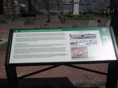
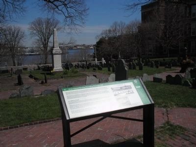
When Copp’s Hill was first established as the “North Burying Ground,” it was just below the summit of one of Boston’s highest hills. Looking north over the colonial wharves one could see the towns of Charlestown and Chelsea and the confluence of the Charles and Mystic Rivers. There were no trees in the burying ground, as all were cut down for buildings and firewood. The gravestones were placed either in family groups or haphazardly throughout the field. In the 1710s, the first tombs were built around the edge of the grounds.
In the 19th century, burying grounds were transformed into “parks.” Many families removed their ancestors to newer cemeteries, such as Mount Auburn and Forest Hills. At Copp’s Hill in the 1830s, the cemetery department “organized” the gravestones into rows; installed paths, steps and walls; and built a small building where you are now standing. The “View of Copp’s Hill” published in 1851 shows Bostonians promenading through the burying ground. Additional changes were made in 1878. Today, visitors can see portions of the Charlestown waterfront through the trees and buildings.
The Lighthouse Tragedy
In 1716, the first lighthouse in North America was built on Little Brewster Island in Boston Harbor. George Worthylake (c. 1673-1718), the first lighthouse keeper, lived on Little Brewster with his wife Ann, at least five children, and their slaves Shadwell and Dina. Worthylake lit the tower for the first time on September 14, 1716. He also served as a harbor pilot.
Tragedy struck on November 3, 1718, as reported in the Boston Newsletter: “On Monday last the 3d Currant and awful and Lamentable Providence fell out here, Mr. George Worthylake (Master of the Light House upon the Great Brewster [called Beacon Island] at the Entrance of the Harbour of Boston) Anne his Wife, Ruth their Daughter, George Cutler, a Servant, Shadwell their Negro Slave, and Mr. John Edge a Passenger; being on the Lord’s Day here at Sermon, and going home in a Sloop, dropt Anchor near the Landing place, and all got into a little Boat or Cannoo, designing to go on Shoar, but by Accident it overwhelmed, so that they were Drowned, and all found and Interred except George Cutler.”
The tragic event was witnessed by their teenage daughter, Ann Worthylake, and her friend Mary Thompson. Young Ann Worthylake married stonecutter John Gaud within months. He may have carved the triple gravestone of George, Ann, and Ruth Worthylake (F-257.) Benjamin Franklin, then a teenaged apprentice to his brother John, reported in his Autobiography that he wrote a “wretched” poem about the mass drowning called the “Lighthouse Tragedy” that was sold on the streets of Boston.
Topics and series.
This historical marker is listed in these topic lists: Cemeteries & Burial Sites • Colonial Era. In addition, it is included in the Lighthouses series list. A significant historical month for this entry is September 1996.
Location. 42° 22.041′ N, 71° 3.356′ W. Marker is in Boston, Massachusetts, in Suffolk County. It is in North End. Marker can be reached from Hull Street, on the left when traveling east. Marker is located along the walking trail in Copp's Hill Burying Ground. Touch for map. Marker is in this post office area: Boston MA 02113, United States of America. Touch for directions.
Other nearby markers. At least 8 other markers are within walking distance of this marker. Unusual Gravestones (here, next to this marker); Seventeenth Century Copp’s Hill (a few steps from this marker); Copp’s Hill Burying Ground (within shouting distance of this marker); Gravestone Art: Skulls, Wings, and Other Symbols (within shouting distance of this marker); a different marker also named Copp's Hill Burying Ground (within shouting distance of this marker); African Americans at Copp’s Hill (within shouting distance of this marker); Welcome to Copp’s Hill Burying Ground (within shouting distance of this marker); The Mathers (within shouting distance of this marker). Touch for a list and map of all markers in Boston.
Click on the ad for more information.
Please report objectionable advertising to the Editor.
sectionhead>More about this marker. The top of the marker contains a picture of the “View of Copps Hill c. 1851 engraving from Epitaphs from Copp’s Hill Burying Ground by Bridgman. Courtesy of the Society for the Preservation of New England Antiquities.” Under this is a picture of “Boston Light c. 1729, by William Burgess. Courtesy of the Mariners Museum, Newport News, Virginia.”Please report objectionable advertising to the Editor.
Related markers. Click here for a list of markers that are related to this marker. Take a tour of the markers found in Copp’s Hill Burying Ground.
Also see . . . Copp's Hill Burying Ground. Details of the Freedom Trail from the City of Boston website. (Submitted on May 12, 2009, by Bill Coughlin of Woodland Park, New Jersey.)
Credits. This page was last revised on January 30, 2023. It was originally submitted on May 12, 2009, by Bill Coughlin of Woodland Park, New Jersey. This page has been viewed 1,580 times since then and 24 times this year. Last updated on February 15, 2022, by Carl Gordon Moore Jr. of North East, Maryland. Photos: 1, 2. submitted on May 12, 2009, by Bill Coughlin of Woodland Park, New Jersey. • J. Makali Bruton was the editor who published this page.

